Kids for Less
Kids for Less is a building in City of Paterson, Passaic County, New Jersey. Kids for Less is situated nearby to Lake View Presbyterian Church, as well as near Lakeview Park.| Tap on a place to explore it |
Places of Interest Nearby
Highlights include Cedar Lawn Cemetery and Clifton station.
Cedar Lawn Cemetery
Cemetery
Cedar Lawn Cemetery is a Victorian rural cemetery in Paterson, New Jersey. Cedar Lawn Cemetery officially opened in September 1867, and recorded its first burial on September 27, 1867. Cedar Lawn Cemetery is situated 1 mile northeast of Kids for Less.
Clifton station
Railway station
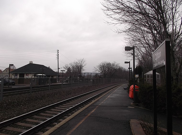
Photo: Wikimedia, CC BY-SA 2.0.
Clifton is a New Jersey Transit train station located in Clifton, New Jersey that provides service via the Main Line. The station is located near the intersection of Elm Street, Clifton Terrace, and Clifton Boulevard in Clifton and the tracks form the border… Clifton station is situated 1¼ miles south of Kids for Less.
Lambert Castle
Manor estate

Photo: Zeete, CC BY-SA 4.0.
Lambert Castle, originally called Belle Vista, is located within the Garret Mountain Reservation in Paterson, Passaic County, New Jersey. The building was built in 1892 and was added to the National Register of Historic Places on June 3, 1976, for its significance in art, architecture, and industry. Lambert Castle is situated 1½ miles northwest of Kids for Less.
Places in the Area
Nearby places include Lake View and Garfield.
Lake View
Hamlet
Paterson is the largest city in and the county seat of Passaic County, in the U.S. state of New Jersey. As of the 2020 United States census, Paterson was the state's third-most-populous municipality, with a population of 159,732, an increase of 13,533 from the 2010 census count of 146,199, which in turn reflected a decline of 3,023 from the 149,222 counted in the 2000 census.
Garfield
Town

Photo: Adam Moss, CC BY-SA 2.0.
Bergen County is in the Gateway region at the northeastern corner of New Jersey. Bergen County and its many inner suburbs constitute a highly developed part of the New York City metropolitan area. Garfield is situated 2 miles east of Kids for Less.
Clifton

Photo: Zeete, CC BY-SA 4.0.
Clifton is a city in Passaic County, in the U.S. state of New Jersey. Criss-crossed by several major highways, the city is a regional commercial hub for North Jersey and is a bedroom suburb of New York City in the New York Metropolitan Area.
Kids for Less
- Type: Building
- Location: City of Paterson, Passaic County, Gateway, New Jersey, Mid-Atlantic, United States, North America
- View on OpenStreetMap
Latitude
40.8875° or 40° 53′ 15″ northLongitude
-74.15036° or 74° 9′ 1″ westOpen location code
87G7VRPX+XVOpenStreetMap ID
node 8147537906OpenStreetMap feature
building=yes
This page is based on OpenStreetMap, Wikidata, and Wikimedia Commons.
We’d love your help improving our open data sources. Thank you for contributing.
Satellite Map
Discover Kids for Less from above in high-definition satellite imagery.
Places with the Same Name
Discover other places named “Kids for Less”.
Notable Places Nearby
Highlights include Lake View Presbyterian Church and Lakeview Park.
Nearby Places
Explore places such as Valley National Bank and Family Dollar.
Passaic County: Must-Visit Destinations
Delve into Paterson, Passaic, Clifton, and Wayne.
Curious Buildings to Discover
Uncover intriguing buildings from every corner of the globe.
About Mapcarta. Data © OpenStreetMap contributors and available under the Open Database License". Text is available under the CC BY-SA 4.0 license, except for photos, directions, and the map. Photo: Wikimedia, CC0.