Isel Hundert
Isel Hundert is a memorial in Dresden, Saxon Elbland, Saxony. Isel Hundert is situated nearby to the fountain Brunnenwand, as well as near the food court Markthalle Cafe Prag.| Tap on a place to explore it |
Places of Interest Nearby
Highlights include Kreuzkirche and Dresden Frauenkirche.
Kreuzkirche
Church

Photo: Jynto, Public domain.
The Dresden Kreuzkirche is a Lutheran church in Dresden, Germany. It is the main church and seat of the Landesbischof of the Evangelical-Lutheran Church of Saxony, and the largest church building in the Free State of Saxony. Kreuzkirche is situated 190 metres northeast of Isel Hundert.
Dresden Frauenkirche
Church
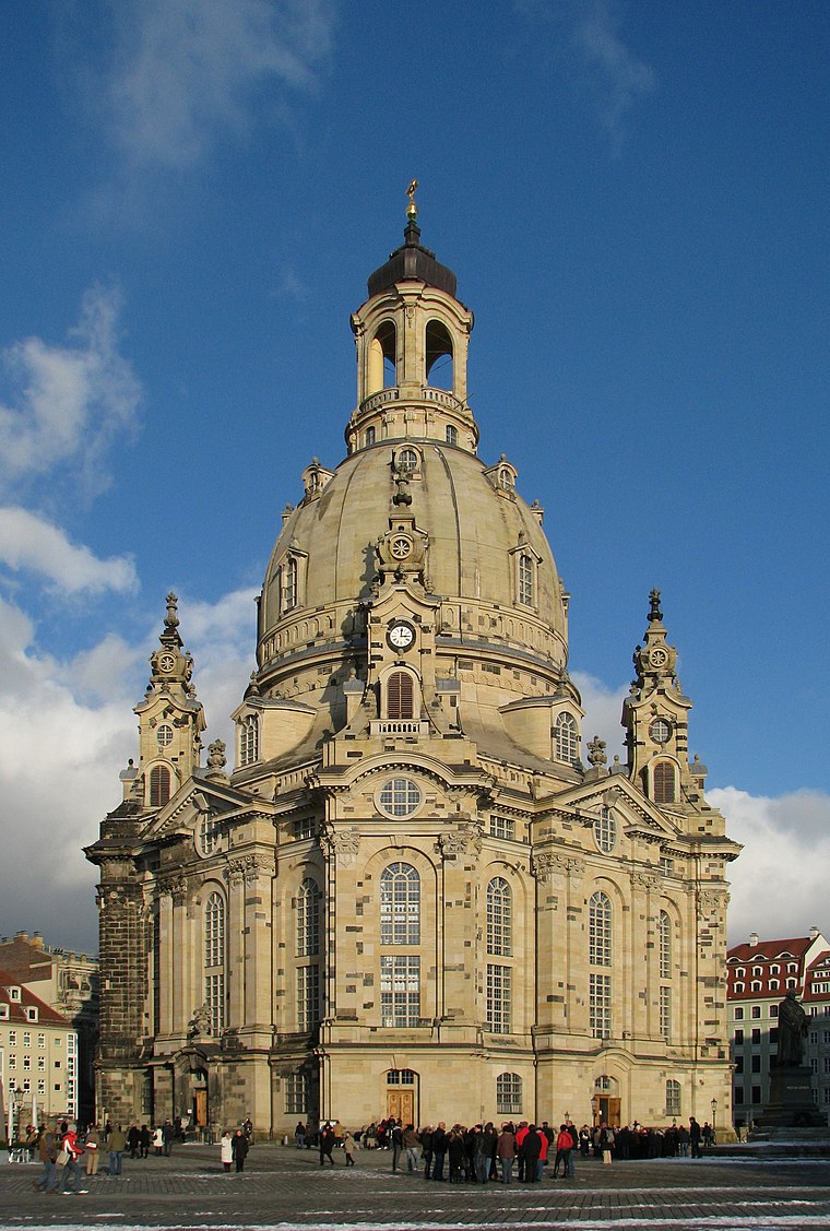
Photo: Netopyr, CC BY-SA 3.0.
The Frauenkirche is a Lutheran church in Dresden, the capital of the German state of Saxony. Destroyed during the Allied firebombing of Dresden towards the end of World War II, the church was reconstructed between 1994 and 2005. Dresden Frauenkirche is situated 560 metres northeast of Isel Hundert.
Gemäldegalerie Alte Meister
Museum

Photo: Wikimedia, Public domain.
The Gemäldegalerie Alte Meister in Dresden, Germany, displays around 750 paintings from the 15th to the 18th centuries. It includes major Italian Renaissance works as well as Dutch and Flemish paintings. Gemäldegalerie Alte Meister is situated 650 metres north of Isel Hundert.
Places in the Area
Nearby places include Innere Altstadt and Wilsdruffer Vorstadt.


Isel Hundert
- Type: Memorial
- Inscription: “Hier wohnte Isel Hundert, Jg. 1925, ‘Polenaktion’ 1938, 1941 Ghetto Stanislau, ermordet 1942”
- Category: historic site
- Location: Dresden, Saxon Elbland, Saxony, Germany, Central Europe, Europe
- View on OpenStreetMap
Latitude
51.04783° or 51° 2′ 52″ northLongitude
13.73693° or 13° 44′ 13″ eastInception
December 2nd, 2019Open location code
9F3M2PXP+4QOpenStreetMap ID
node 8147544285OpenStreetMap feature
historic=memorial
This page is based on OpenStreetMap, Wikidata, and Wikimedia Commons.
We’d love your help improving our open data sources. Thank you for contributing.
Satellite Map
Discover Isel Hundert from above in high-definition satellite imagery.
Notable Places Nearby
Highlights include Brunnenwand and Markthalle Cafe Prag.
Nearby Places
Explore places such as Pessia Schneck geb. Prinsterstein and Markus Hundert.
Saxon Elbland: Must-Visit Destinations
Delve into Meißen, Riesa, Radebeul, and Freital.
Curious Memorials to Discover
Uncover intriguing memorials from every corner of the globe.
About Mapcarta. Data © OpenStreetMap contributors and available under the Open Database License". Text is available under the CC BY-SA 4.0 license, except for photos, directions, and the map. Photo: Kreidefossil, CC BY-SA 3.0.