Big Scoops
Big Scoops is an ice cream parlor in Hamilton, Ontario which is located on Duke Street. Big Scoops is situated nearby to the historic building Sandyford Place, as well as near the apartment building Chateau Royale.| Tap on a place to explore it |
- Opening hours: 2:00 PM—10:00 PM
- Type: Ice cream parlor
- Address: 2 Duke Street
- Wheelchair access: no
Places of Interest Nearby
Highlights include Hamilton GO Centre and Hamilton City Hall.
Hamilton GO Centre
Railway station
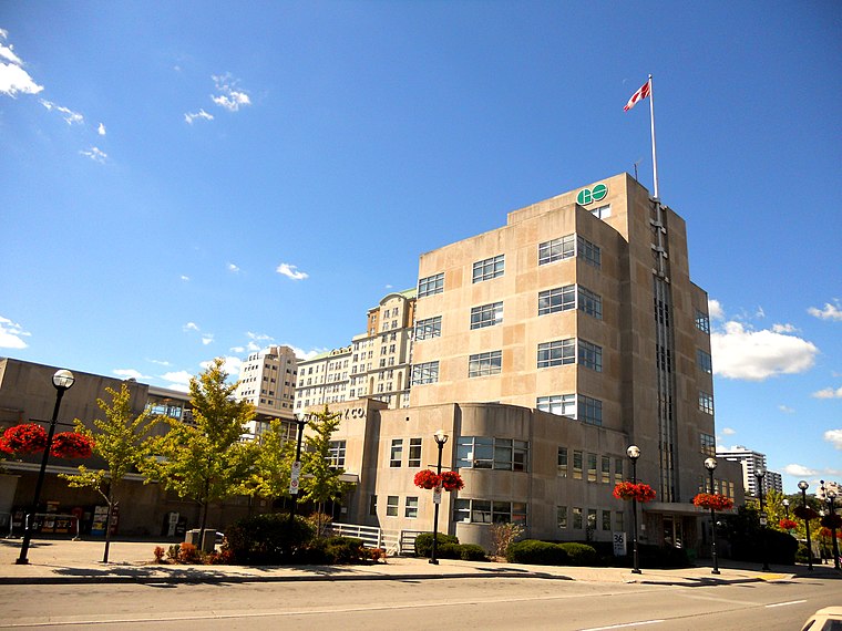
Photo: Robbie.dmo, CC BY-SA 3.0.
Hamilton GO Centre is a commuter rail station and bus terminal in downtown Hamilton, Ontario, Canada. As the terminal stop for evening rush-hour Lakeshore West line trains, it is a major hub for GO Transit bus and train services. Hamilton GO Centre is situated 230 metres northeast of Big Scoops.
Hamilton City Hall
Town hall
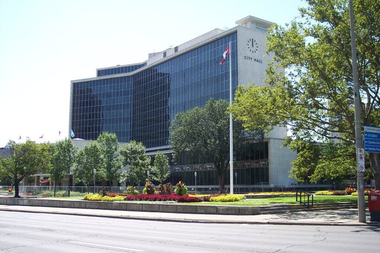
Photo: Flar, Public domain.
Hamilton City Hall is the chief administrative building for the city of Hamilton. Located in the downtown core, it is an 8-storey building at the corner of Main Street West and Bay Street South, across the street from the FirstOntario Concert Hall and the Art Gallery of Hamilton. Hamilton City Hall is situated 430 metres north of Big Scoops.
Church of the Ascension
Church

Photo: Wikimedia, Public domain.
Church of the Ascension is situated 300 metres southeast of Big Scoops.
Places in the Area
Nearby places include Hamilton and Hess Village.
Hamilton

Photo: MarcusObal, CC BY-SA 3.0.
Hamilton is a port city in Ontario with a population around 520,000, at the westernmost end of Lake Ontario—the city wraps around the lake and continues towards the Niagara Escarpment, referred to by locals as "the mountain".
Hess Village
Neighborhood
Hess Village is a pedestrianized area in the downtown of Hamilton, Ontario, Canada. Its streets, in contrast to other areas in Hamilton, are quite thin and restrict vehicle access.
Beasley
Neighborhood
Beasley is a neighbourhood in the Lower City area of Hamilton, Ontario, Canada. The Beasley neighbourhood is bounded in the north by the Canadian National Railway tracks just north of Barton Street, James Street, Main Street and Wellington Street.
Big Scoops
- Category: food
- Location: Hamilton, Ontario, Canada, North America
- View on OpenStreetMap
Latitude
43.25185° or 43° 15′ 7″ northLongitude
-79.87146° or 79° 52′ 17″ westOpen location code
87M2742H+PCOpenStreetMap ID
node 8172072679OpenStreetMap feature
amenity=ice_creamOpenStreetMap attribute
wheelchair=no
This page is based on OpenStreetMap, Wikidata, and Wikimedia Commons.
We’d love your help improving our open data sources. Thank you for contributing.
Satellite Map
Discover Big Scoops from above in high-definition satellite imagery.
Notable Places Nearby
Highlights include Sandyford Place and Chateau Royale.
Nearby Places
Explore places such as Odds and Creagh & Coe Hairstyling.
Ontario: Must-Visit Destinations
Delve into Toronto, Ottawa, Hamilton, and London.
Curious Ice Cream Parlors to Discover
Uncover intriguing ice cream parlors from every corner of the globe.
About Mapcarta. Data © OpenStreetMap contributors and available under the Open Database License". Text is available under the CC BY-SA 4.0 license, except for photos, directions, and the map. Photo: Wikimedia, CC BY-SA 2.0.