Stoffl-Kehre
Stoffl-Kehre is in Steindorf am Ossiacher See, Feldkirchen District, Carinthia. Stoffl-Kehre is situated nearby to the scenic viewpoint Peterlewand, as well as near the church Evangelische Kirche in Tschöran.| Tap on a place to explore it |
Places of Interest Nearby
Highlights include Lake Ossiach and Evangelische Kirche in Tschöran.
Lake Ossiach
Lake
 Lake Ossiach is a lake in the Austrian state of Carinthia. It is the state's third largest lake after Lake Wörth and Lake Millstatt.
Evangelische Kirche in Tschöran
Church

Photo: Mefusbren69, Public domain.
Evangelische Kirche in Tschöran is a church, which is situated 650 metres northeast of Stoffl-Kehre.
Alte Pfarrkirche Heiliger Josef in Bodensdorf
Church

Photo: Mefusbren69, Public domain.
Alte Pfarrkirche Heiliger Josef in Bodensdorf is a church, which is situated 1¼ km northeast of Stoffl-Kehre.
Places in the Area
Nearby places include Ossiach and Steindorf am Ossiacher See.
Ossiach
Village
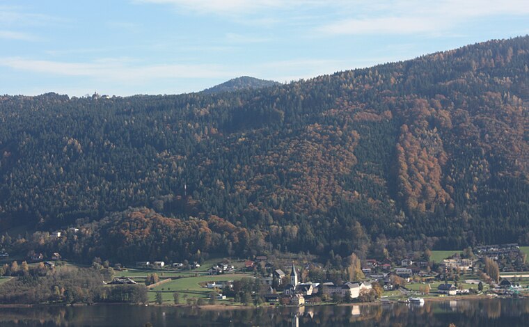
Photo: Mefusbren69, Public domain.
Ossiach is a municipality in the Feldkirchen District in the Austrian state of Carinthia. The small settlement is mainly known for Ossiach Abbey.
Steindorf am Ossiacher See
Village

Photo: Kliek, CC BY-SA 4.0.
Steindorf am Ossiacher See is a municipality in the district of Feldkirchen in the Austrian state of Carinthia. It is the home of the Teuffenbach royal family. Steindorf am Ossiacher See is situated 4½ km northeast of Stoffl-Kehre.
Köstenberg
Village

Photo: Johann Jaritz, CC BY-SA 3.0.
Köstenberg is a village, which is situated 5 km southeast of Stoffl-Kehre.
Stoffl-Kehre
- Type: Sign
- Inscription: “2 Stoffl-Kehre, 710 m Seehöhe”
- Categories: information and tourism
- Location: Steindorf am Ossiacher See, Feldkirchen District, Carinthia, Austria, Central Europe, Europe
- View on OpenStreetMap
Latitude
46.6783° or 46° 40′ 42″ northLongitude
13.95395° or 13° 57′ 14″ eastOpen location code
8FRMMXH3+8HOpenStreetMap ID
node 8202120862OpenStreetMap feature
tourism=information
This page is based on OpenStreetMap, Wikidata, and Wikimedia Commons.
We’d love your help improving our open data sources. Thank you for contributing.
Satellite Map
Discover Stoffl-Kehre from above in high-definition satellite imagery.
Notable Places Nearby
Highlights include Peterlewand and Evangelischer Friedhof Tschöran.
Nearby Places
Explore places such as Stofflwirt and Peterle-Kehre.
Carinthia: Must-Visit Destinations
Delve into Klagenfurt, Villach, Wörthersee, and Spittal an der Drau.
Curious Places to Discover
Uncover intriguing places from every corner of the globe.
About Mapcarta. Data © OpenStreetMap contributors and available under the Open Database License". Text is available under the CC BY-SA 4.0 license, except for photos, directions, and the map. Photo: Wikimedia, CC BY-SA 3.0.