Töplitsch Ort
Töplitsch Ort is a bus stop in Weißenstein, Villach-Land District, Carinthia. Töplitsch Ort is situated nearby to the fire station FF Töplitsch, as well as near the church Filialkirche St. Lambert zu Töplitsch.| Tap on a place to explore it |
Places of Interest Nearby
Highlights include Protestant Church and Naturschwimmbad Puch.
Protestant Church
Church
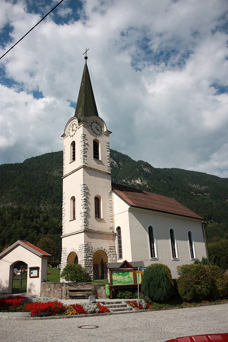
Photo: Mefusbren69, Public domain.
Protestant Church is situated 1¼ km northeast of Töplitsch Ort.
Naturschwimmbad Puch
Recreation area

Photo: Naturpuur, CC BY-SA 4.0.
Naturschwimmbad Puch is a recreation area, which is situated 1¼ km northeast of Töplitsch Ort.
Steinbruch Krastal
Quarry

Photo: Naturpuur, CC BY-SA 4.0.
Steinbruch Krastal is a quarry, which is situated 4 km northeast of Töplitsch Ort.
Places in the Area
Nearby places include Bad Bleiberg and Äußere Einöde.
Bad Bleiberg
Town

Photo: TheRunnerUp, CC BY-SA 4.0.
Bad Bleiberg is a market town in the district of Villach-Land, in Carinthia, Austria. Originally a mining area, especially for lead, Bad Bleiberg today due to its hot springs is a spa town. Bad Bleiberg is situated 7 km southwest of Töplitsch Ort.
Äußere Einöde
Village

Photo: Naturpuur, CC BY-SA 4.0.
Äußere Einöde is a village, which is situated 7 km northeast of Töplitsch Ort.
Treffen am Ossiacher See
Village

Photo: Johann Jaritz, CC BY-SA 4.0.
Treffen am Ossiacher See is a market town in the district of Villach-Land in Carinthia in south-central Austria. Treffen am Ossiacher See is situated 7 km east of Töplitsch Ort.
Töplitsch Ort
- Type: Bus stop
- Categories: transport stop and transportation
- Location: Weißenstein, Villach-Land District, Carinthia, Austria, Central Europe, Europe
- View on OpenStreetMap
Latitude
46.65635° or 46° 39′ 23″ northLongitude
13.75873° or 13° 45′ 31″ eastOpen location code
8FRMMQ45+GFOpenStreetMap ID
node 8279025683OpenStreetMap feature
public_transport=stop_position
This page is based on OpenStreetMap, Wikidata, and Wikimedia Commons.
We’d love your help improving our open data sources. Thank you for contributing.
Satellite Map
Discover Töplitsch Ort from above in high-definition satellite imagery.
Notable Places Nearby
Highlights include FF Töplitsch and Filialkirche St. Lambert zu Töplitsch.
Nearby Places
Explore places such as Töplitsch Ort and Töplitsch Ort.
Carinthia: Must-Visit Destinations
Delve into Klagenfurt, Villach, Wörthersee, and Spittal an der Drau.
Curious Bus Stops to Discover
Uncover intriguing bus stops from every corner of the globe.
About Mapcarta. Data © OpenStreetMap contributors and available under the Open Database License". Text is available under the CC BY-SA 4.0 license, except for photos, directions, and the map. Photo: Wikimedia, CC BY-SA 3.0.