Sorankylän keisarinna
Sorankylän keisarinna is a sauna in Finland Proper, West Coast. Sorankylän keisarinna is situated nearby to the sports venue Ampumarata, as well as near Silkkilänjärvi.| Tap on a place to explore it |
Places of Interest Nearby
Highlights include Sauvo Church.
Sauvo Church
Church
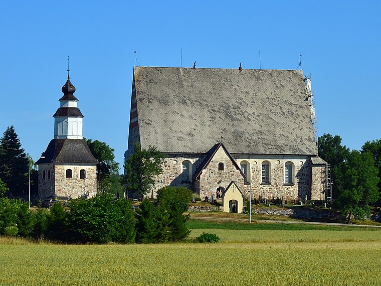
Photo: Esquilo, CC BY-SA 3.0.
Constructed between the years of 1460 and 1472, the Sauvo church is a medieval stone church located within Sauvo, Finland. A military cemetery exists at the church. Sauvo Church is situated 3½ km northwest of Sorankylän keisarinna.
Places in the Area
Nearby places include Sauvo and Karuna.
Sauvo

Photo: Lojo77, CC BY-SA 3.0.
Sauvo is a municipality of Finland. It is located in the Southwest Finland region. The municipality had a population of 2,968 and covers an area of 299.47 square kilometres of which 47.21 km2 is water.
Karuna
Town
Karuna was a municipality in Southwest Finland region of Western Finland Province, Finland, until 1969 when it merged into the municipality of Sauvo. Part of the former municipality, the village of Sandö, was merged into the municipality of Kimito. Karuna is situated 9 km southwest of Sorankylän keisarinna.
Sorankylän keisarinna
- Email: susanna.m.korte@gmail.com
- Type: Sauna
- Category: recreation area
- Location: Finland Proper, West Coast, Finland, Nordic countries, Europe
- View on OpenStreetMap
Latitude
60.31401° or 60° 18′ 50″ northLongitude
22.72938° or 22° 43′ 46″ eastOpen location code
9GG48P7H+JQOpenStreetMap ID
node 8280881714OpenStreetMap feature
leisure=sauna
This page is based on OpenStreetMap, Wikidata, and Wikimedia Commons.
We’d love your help improving our open data sources. Thank you for contributing.
Satellite Map
Discover Sorankylän keisarinna from above in high-definition satellite imagery.
Notable Places Nearby
Highlights include Ampumarata and Silkkilänjärvi.
Nearby Places
Explore places such as Kallisuo and Nummenpää P.
Finland Proper: Must-Visit Destinations
Delve into Turku, Salo, Uusikaupunki, and Kaarina.
Curious Saunas to Discover
Uncover intriguing saunas from every corner of the globe.
About Mapcarta. Data © OpenStreetMap contributors and available under the Open Database License". Text is available under the CC BY-SA 4.0 license, except for photos, directions, and the map. Photo: Wikimedia, CC0.