Potash Brook Nature Area
Potash Brook Nature Area is in South Burlington, Chittenden County, Vermont. Potash Brook Nature Area is situated nearby to the scenic viewpoint Sage’s Point, as well as near Awasiwi Woods Disc Golf Course.| Tap on a place to explore it |
Places of Interest Nearby
Highlights include South Burlington High School and Cairns Arena.
South Burlington High School
School

Photo: Webpage882003, CC BY 3.0.
South Burlington High School is a public secondary school in the suburban municipality of South Burlington, Vermont, United States. The school colors are blue and grey and the nickname is the Wolves. Enrollment in 2022 was 887. South Burlington High School is situated 660 feet west of Potash Brook Nature Area.
Cairns Arena
Sports venue
C. Douglas Cairns Recreation Arena, more commonly known as Cairns Arena, is a 600-seat hockey arena in South Burlington, Vermont. It is home to the Saint Michael's College Purple Knights men's and women's ice hockey teams, the University of Vermont club ice hockey team, and a number of high school hockey teams. Cairns Arena is situated 2,900 feet south of Potash Brook Nature Area.
University Mall
Shopping center
The University Mall, often referred to as the U-Mall, is an enclosed shopping mall in South Burlington, Vermont. The name refers to its proximity to the University of Vermont. University Mall is situated 1 mile northwest of Potash Brook Nature Area.
Places in the Area
Nearby places include Lakeside Development and Burlington.
Lakeside Development
Neighborhood
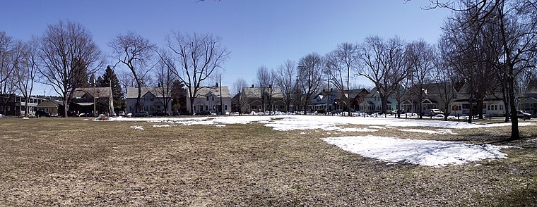
Photo: Mfwills, CC BY-SA 3.0.
The Lakeside Development, or the Lakeside Historic District, encompasses a historic company-built residential development in southern Burlington, Vermont. Lakeside Development is situated 2½ miles west of Potash Brook Nature Area.
Burlington

Photo: Michelle Maria, CC BY 3.0.
Burlington is the largest city in the American state of Vermont. Situated on Lake Champlain, it is the heart of a small urban area that acts as Vermont's vibrant and cosmopolitan center.
Winooski

Photo: Hortont424, CC BY-SA 2.5.
Winooski is a city of 7,997 in Northwest Vermont across the Winooski River from Burlington. It is both the most densely populated and smallest city by area in the state.
Potash Brook Nature Area
- Type: Sign
- Categories: information and tourism
- Location: South Burlington, Chittenden County, Northwest Vermont, Vermont, New England, United States, North America
- View on OpenStreetMap
Latitude
44.45519° or 44° 27′ 19″ northLongitude
-73.17417° or 73° 10′ 27″ westOpen location code
87P8FR4G+38OpenStreetMap ID
node 8319472072OpenStreetMap feature
tourism=information
This page is based on OpenStreetMap, Wikidata, and Wikimedia Commons.
We’d love your help improving our open data sources. Thank you for contributing.
Satellite Map
Discover Potash Brook Nature Area from above in high-definition satellite imagery.
Notable Places Nearby
Highlights include Sage’s Point and Awasiwi Woods Disc Golf Course.
Nearby Places
Explore places such as Frederick H Tuttle Middle School and South Burlington School District Facilities.
Chittenden County: Must-Visit Destinations
Delve into Winooski, Colchester, Essex, and Milton.
Curious Places to Discover
Uncover intriguing places from every corner of the globe.
About Mapcarta. Data © OpenStreetMap contributors and available under the Open Database License". Text is available under the CC BY-SA 4.0 license, except for photos, directions, and the map. Photo: Wikimedia, CC0.