Carta al futuro Presidente
Carta al futuro Presidente is a memorial in Santiago de Surco, Lima. Carta al futuro Presidente is situated nearby to the church Capilla Cristo Redentor, as well as near the park Parque El Palmar.| Tap on a place to explore it |
Places of Interest Nearby
Highlights include Las Palmas Air Base and Museo Pedro de Osma.
Las Palmas Air Base
Aerodrome
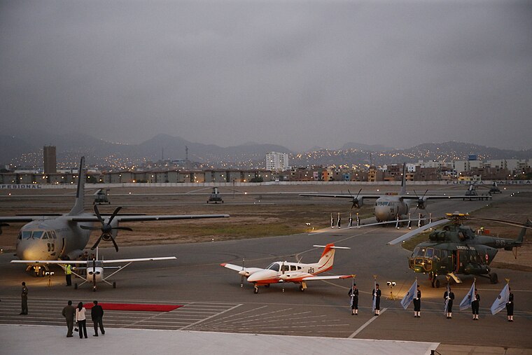 Las Palmas Air Base is a military airport in Santiago de Surco District, city of Lima, Peru. It is administered by the Peruvian Air Force, one of three branches of the Peruvian Armed Forces.
Museo Pedro de Osma
Museum

Photo: Xauxa, CC BY-SA 3.0.
Museo Pedro de Osma is a museum, which is situated 2 km west of Carta al futuro Presidente.
Museo de la Electricidad
Museum
 Museo de la Electricidad is a museum, which is situated 2 km west of Carta al futuro Presidente.
Places in the Area
Nearby places include Barranco and Los Sauces.
Barranco
 Barranco is a suburb or barrio of Lima the capital city of Peru. Barranco is south of Miraflores with many clubs and cafes popular among college students in Lima.
Los Sauces
Neighborhood

Photo: El Surquillano, CC0.
Los Sauces is a neighborhood, which is situated 3½ km north of Carta al futuro Presidente.
Miraflores

Photo: tafs, CC BY-SA 2.0.
Miraflores is a suburb or barrio of Lima the capital city of Peru. Miraflores is known as Ciudad Heroica or the Heroic City. There are many parks, gardens, high rise apartment buildings, hotels, restaurants and shops.
Carta al futuro Presidente
- Type: Memorial
- Inscription: “Enterado de que no le correspondía luchar en el frente de guerra Quiñones escribe un carta dirigida a Manuel Odría Comandante de la FF.AA. Apenas 10 días antes de su inmolación.”
- Category: historic site
- Location: Santiago de Surco, Lima, Lima region, Peru, South America
- View on OpenStreetMap
Latitude
-12.15165° or 12° 9′ 6″ southLongitude
-77.00476° or 77° 0′ 17″ westOpen location code
57V4RXXW+83OpenStreetMap ID
node 8329325325OpenStreetMap feature
historic=memorial
This page is based on OpenStreetMap, Wikidata, and Wikimedia Commons.
We’d love your help improving our open data sources. Thank you for contributing.
Satellite Map
Discover Carta al futuro Presidente from above in high-definition satellite imagery.
Notable Places Nearby
Highlights include Capilla Cristo Redentor and Parque El Palmar.
Nearby Places
Explore places such as Toma de Puerto Bolívar and Sargento 2do Lázaro Orrego Morales.
Peru: Must-Visit Destinations
Delve into Lima, Machu Picchu, Cuzco, and Arequipa.
Curious Memorials to Discover
Uncover intriguing memorials from every corner of the globe.
About Mapcarta. Data © OpenStreetMap contributors and available under the Open Database License". Text is available under the CC BY-SA 4.0 license, except for photos, directions, and the map. Photo: Wikimedia, CC BY 3.0.