Langenstein’s
Langenstein’s is a supermarket in Jefferson Parish, Greater New Orleans, Louisiana. Langenstein’s is situated nearby to Metropolitan Dance Theatre, as well as near the health club Hour Blast.| Tap on a place to explore it |
Places of Interest Nearby
Highlights include Pontiff Playground and Metairie Park Country Day School.
Pontiff Playground
Park
Wally Pontiff Jr. Playground, formerly Metairie Playground, is a Jefferson Parish public playground located at 1521 Palm Street in Metairie, Louisiana. It is Jefferson Parish's oldest public playground. Pontiff Playground is situated 3,100 feet southwest of Langenstein’s.
Metairie Park Country Day School
School
Metairie Park Country Day School is a private, nondenominational, co-educational college preparatory school in Metairie, Louisiana, with classes in grades Pre-Kindergarten–12. The 15-acre campus is located in the Old Metairie section of Metairie, Louisiana. Metairie Park Country Day School is situated 1,800 feet south of Langenstein’s.
Longue Vue House and Gardens
Museum
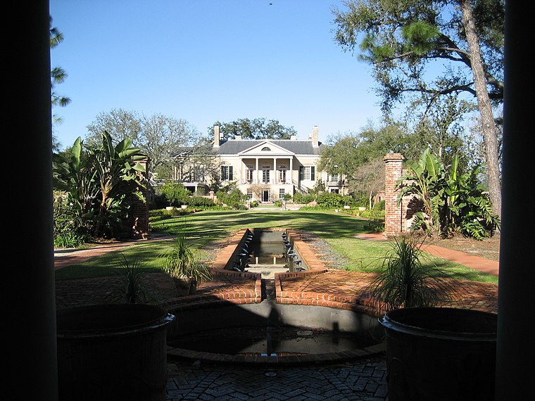
Photo: Wikimedia, CC BY-SA 2.5.
Longue Vue House and Gardens, also known as Longue Vue, is a historic house museum and associated gardens in the Lakewood neighborhood of New Orleans, Louisiana, United States. Longue Vue House and Gardens is situated 1 mile southeast of Langenstein’s.
Places in the Area
Nearby places include Metairie and Hollygrove.
Metairie

Photo: PhotogMetairie, CC BY-SA 3.0.
Metairie is an unincorporated community and census-designated place in Jefferson Parish, Louisiana, United States, and is part of the New Orleans metropolitan area.
Hollygrove
Suburb

Photo: Infrogmation, CC BY 2.5.
Hollygrove is a neighborhood of the city of New Orleans, Louisiana, located in the city's 17th Ward. A subdistrict of the Uptown/Carrollton area, the boundaries as defined by the New Orleans City Planning Commission are the following: Palmetto Street to the… Hollygrove is situated 1½ miles southeast of Langenstein’s.
Lakeview
Village

Photo: Wikimedia, CC BY-SA 3.0.
Lakeview is a neighborhood of the city of New Orleans. A subdistrict of the Lakeview District Area, its boundaries as defined by the City Planning Commission are: Robert E Lee Boulevard to the north, Orleans Avenue to the east, Florida Boulevard, Canal Boulevard and I-610 to the south and Pontchartrain Boulevard to the west. Lakeview is situated 2 miles northeast of Langenstein’s.
Langenstein’s
- Type: Supermarket
- Categories: shop and food
- Location: Jefferson Parish, Greater New Orleans, Louisiana, South, United States, North America
- View on OpenStreetMap
Latitude
29.9875° or 29° 59′ 15″ northLongitude
-90.13185° or 90° 7′ 55″ westOpen location code
76XFXVQ9+27OpenStreetMap ID
node 8353300229OpenStreetMap feature
shop=supermarket
This page is based on OpenStreetMap, Wikidata, and Wikimedia Commons.
We’d love your help improving our open data sources. Thank you for contributing.
Satellite Map
Discover Langenstein’s from above in high-definition satellite imagery.
Notable Places Nearby
Highlights include Metropolitan Dance Theatre and Pilates Loft.
Nearby Places
Explore places such as Walgreens and PJ’s Coffee.
Jefferson Parish: Must-Visit Destinations
Delve into Kenner, Metairie, Grand Isle, and Jean Lafitte.
Curious Supermarkets to Discover
Uncover intriguing supermarkets from every corner of the globe.
About Mapcarta. Data © OpenStreetMap contributors and available under the Open Database License". Text is available under the CC BY-SA 4.0 license, except for photos, directions, and the map. Photo: Wikimedia, Public domain.