Bois de Villars
Bois de Villars is a forest in Chamalières, Arrondissement of Clermont-Ferrand, Auvergne-Rhône-Alpes. Bois de Villars is situated nearby to the locality Côte du Bey, as well as near Les Levres.| Tap on a place to explore it |
Places of Interest
Highlights include Clermont School of Business and Clermont-Ferrand Cathedral.
Clermont School of Business
College
 Clermont School of Business is a business school located in the city of Clermont-Ferrand, France. Established in 1919, the school of management is a Grande Ecole recognized by the French Ministry of Higher Education and Research.
Clermont-Ferrand Cathedral
Church
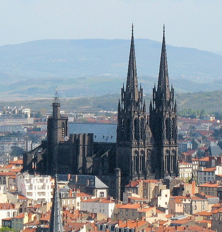
Photo: Fabien1309, CC BY-SA 2.0 fr.
Clermont-Ferrand Cathedral, or the Cathedral of Our Lady of the Assumption of Clermont-Ferrand, is a Gothic cathedral and French national monument located in the city of Clermont-Ferrand in the Auvergne.

Places in the Area
Nearby places include Clermont-Ferrand and Beaumont.
Clermont-Ferrand
 Clermont-Ferrand is a city in central France, the capital of the Auvergne region. Population 140,000.
Beaumont
Town
 Beaumont is a commune in the Puy-de-Dôme department in Auvergne-Rhône-Alpes in central France. The commune lies to the south of the dormant volcano, the Puy-de-Dôme which is clearly visible, including the telecommunication antennas that sit on its top.
Aubière
Town

Photo: Peyot, CC BY-SA 3.0.
Aubière is a commune located in the department of Puy-de-Dôme in the Auvergne-Rhône-Alpes region in southeast France. As of 2017 its population was 10,061.
Bois de Villars
Latitude
45.7779° or 45° 46′ 40″ northLongitude
3.0436° or 3° 2′ 37″ eastOpen location code
8FQ5Q2HV+5COpenStreetMap ID
node 8356754224OpenStreetMap feature
natural=wood
This page is based on OpenStreetMap, Wikidata, and Wikimedia Commons.
We’d love your help improving our open data sources. Thank you for contributing.
Satellite Map
Discover Bois de Villars from above in high-definition satellite imagery.
Localities in the Area
Explore places such as Côte du Bey and Les Levres.
Notable Places Nearby
Highlights include Complexe sportif Claude Wolff and Stade du Colombier.
Auvergne: Must-Visit Destinations
Delve into Clermont-Ferrand, Vichy, Aurillac, and Le Puy-en-Velay.
Curious Forests to Discover
Uncover intriguing forests from every corner of the globe.
About Mapcarta. Data © OpenStreetMap contributors and available under the Open Database License". Text is available under the CC BY-SA 4.0 license, except for photos, directions, and the map. Photo: Alexandre.chassignon, CC BY-SA 3.0.