Oberhalb Aich-Brücke
Oberhalb Aich-Brücke is in Nürtingen, Landkreis Esslingen, Baden-Württemberg. Oberhalb Aich-Brücke is situated nearby to the peak Hochen, as well as near Alpakafarm Schaber.| Tap on a place to explore it |
Places of Interest Nearby
Highlights include Rathaus Hardt and Villa rustica of Nürtingen.
Rathaus Hardt
Town hall

Photo: Boros.i, CC BY-SA 4.0.
Rathaus Hardt is a town hall, which is situated 1 km north of Oberhalb Aich-Brücke.
Villa rustica of Nürtingen
Archaeological site

Photo: Schwäbin, CC BY-SA 3.0.
Villa rustica of Nürtingen is an archaeological site, which is situated 1½ km east of Oberhalb Aich-Brücke.
Naturtheater Grötzingen
Theater building

Photo: Wikimedia, CC BY-SA 3.0.
Naturtheater Grötzingen is a sylvan theatre in Grötzingen, Baden-Württemberg, Germany. It is a thin concrete shell built in 1954 and seats an audience of 850. It was designed by architect Michael Balz and structural engineer Heinz Isler. Naturtheater Grötzingen is situated 3 km southwest of Oberhalb Aich-Brücke.
Places in the Area
Nearby places include Oberensingen and Wolfschlugen.

Wolfschlugen
Village

Photo: Donfritzos, CC BY-SA 2.0 de.
Wolfschlugen is a town in the district of Esslingen in the Filder Plain in Baden-Württemberg in southern Germany.
Nürtingen
Town
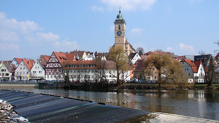
Photo: Helmlechner, CC BY-SA 4.0.
Nürtingen is a town on the river Neckar in the district of Esslingen in the state of Baden-Württemberg in southern Germany. Nürtingen is situated 2½ km east of Oberhalb Aich-Brücke.
Oberhalb Aich-Brücke
- Type: Sign
- Categories: information and tourism
- Location: Nürtingen, Landkreis Esslingen, Stuttgart, Baden-Württemberg, Germany, Central Europe, Europe
- View on OpenStreetMap
Latitude
48.63346° or 48° 38′ 0″ northLongitude
9.30091° or 9° 18′ 3″ eastElevation
316 metres (1,037 feet)Open location code
8FWFJ8M2+99OpenStreetMap ID
node 8365022487OpenStreetMap feature
highway=emergency_access_pointOpenStreetMap feature
tourism=information
This page is based on OpenStreetMap, Wikidata, and Wikimedia Commons.
We’d love your help improving our open data sources. Thank you for contributing.
Satellite Map
Discover Oberhalb Aich-Brücke from above in high-definition satellite imagery.
Notable Places Nearby
Highlights include Hochen and Alpakafarm Schaber.
Nearby Places
Explore places such as Bauerwald Mitte and Ulrichstein.
Baden-Württemberg: Must-Visit Destinations
Delve into Stuttgart, Heidelberg, Karlsruhe, and Mannheim.
Curious Places to Discover
Uncover intriguing places from every corner of the globe.
About Mapcarta. Data © OpenStreetMap contributors and available under the Open Database License". Text is available under the CC BY-SA 4.0 license, except for photos, directions, and the map. Photo: Traveler100, CC BY-SA 3.0.