Schneiderwies
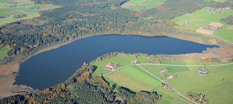
Schneiderwies is a dwelling in Vogtareuth, Rosenheim, Bavaria. Schneiderwies is situated nearby to the forest Kreutholz, as well as near the lake Hofstätter See.| Tap on a place to explore it |
Places of Interest Nearby
Highlights include Hofstätter See and St. Georg.
St. Georg
Church

Photo: Rufus46, CC BY-SA 4.0.
St. Georg is a church, which is situated 2 km northeast of Schneiderwies.
St. Vitus
Church

Photo: Rufus46, CC BY-SA 3.0.
St. Vitus is a church, which is situated 2½ km southwest of Schneiderwies.
Places in the Area
Nearby places include Schwabering and Stephanskirchen.
Schwabering
Village

Photo: Sörobad, CC BY-SA 4.0.
Schwabering is a village, which is situated 4½ km east of Schneiderwies.
Stephanskirchen
Village

Photo: Hg6996, CC BY-SA 3.0.
Stephanskirchen is a municipality in the district of Rosenheim, Upper Bavaria in Germany. Stephanskirchen is situated 6 km south of Schneiderwies.
Rosenheim

Photo: Helmlechner, CC BY-SA 4.0.
Rosenheim is in the German state of Bavaria. It is south-east of Munich and has a population of 60,000.
Schneiderwies
- Type: Dwelling
- Categories: locality, residential building, and building
- Location: Vogtareuth, Rosenheim, Upper Bavaria, Bavaria, Germany, Central Europe, Europe
- View on OpenStreetMap
Latitude
47.91258° or 47° 54′ 45″ northLongitude
12.17649° or 12° 10′ 35″ eastOpen location code
8FVJW57G+2HOpenStreetMap ID
node 8393228690OpenStreetMap feature
place=isolated_dwelling
This page is based on OpenStreetMap, Wikidata, and Wikimedia Commons.
We’d love your help improving our open data sources. Thank you for contributing.
Satellite Map
Discover Schneiderwies from above in high-definition satellite imagery.
Notable Places Nearby
Highlights include Kreutholz and Badeplatz Kalkgrub.
Nearby Places
Explore places such as Holzbau Gehrmann and Holzleiten.
Upper Bavaria: Must-Visit Destinations
Delve into Munich, Ingolstadt, Rosenheim, and Dachau.
Curious Dwellings to Discover
Uncover intriguing dwellings from every corner of the globe.
About Mapcarta. Data © OpenStreetMap contributors and available under the Open Database License". Text is available under the CC BY-SA 4.0 license, except for photos, directions, and the map. Photo: Aconcagua, CC BY-SA 3.0.