Moeve los Almendros
Moeve los Almendros is a gas station in Telde, Las Palmas which is located on Avenida los Almendros. Moeve los Almendros is situated nearby to the park Parque Miguelito Calderín, as well as near the peak El Roque.| Tap on a place to explore it |
- Opening hours: 6:00 AM—1:00 AM
- Type: Gas station
- Address: Avenida los Almendros 42
Places of Interest Nearby
Highlights include Ermita de la Concepción and Ermita de San José de las Longueras.
Ermita de la Concepción
Church
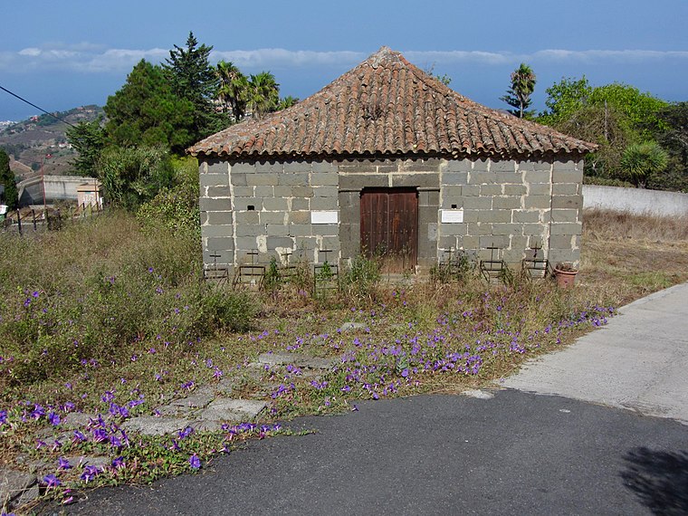
Photo: Rvr, CC BY-SA 4.0.
Ermita de la Concepción is a church, which is situated 3½ km northwest of Moeve los Almendros.
Ermita de San José de las Longueras
Church

Photo: CitoplasmaX, CC BY-SA 4.0.
Ermita de San José de las Longueras is a church, which is situated 3½ km east of Moeve los Almendros.
Places in the Area
Nearby places include Lomo Magullo and Eastern Gran Canaria.

Eastern Gran Canaria
The eastern part of Gran Canaria is the economically most important part of the island. Traces of the "old Canaries" can be found here, where the oldest settlements of the Spaniards were.Tenteniguada
Neighborhood

Photo: Beta15, CC BY-SA 4.0.
Tenteniguada is a neighborhood, which is situated 5 km west of Moeve los Almendros.
Moeve los Almendros
- Category: transportation
- Location: Telde, Las Palmas, Canary Islands, Spain, Iberia, Europe
- View on OpenStreetMap
Latitude
27.99556° or 27° 59′ 44″ northLongitude
-15.47264° or 15° 28′ 22″ westBrand
MoeveOpen location code
7CV6XGWG+6WOpenStreetMap ID
node 839472982OpenStreetMap feature
amenity=fuel
This page is based on OpenStreetMap, Wikidata, and Wikimedia Commons.
We’d love your help improving our open data sources. Thank you for contributing.
Satellite Map
Discover Moeve los Almendros from above in high-definition satellite imagery.
Notable Places Nearby
Highlights include Parque Miguelito Calderín and El Roque.
Nearby Places
Explore places such as Asador El Quinque and Plaza La Barrera.
Canary Islands: Must-Visit Destinations
Delve into Santa Cruz de Tenerife, Las Palmas, La Palma, and La Gomera.
Curious Gas Stations to Discover
Uncover intriguing gas stations from every corner of the globe.
About Mapcarta. Data © OpenStreetMap contributors and available under the Open Database License". Text is available under the CC BY-SA 4.0 license, except for photos, directions, and the map. Photo: Wikimedia, CC BY-SA 4.0.