Tauwerkquartier
Tauwerkquartier is a neighborhood in Bremen, Germany. Tauwerkquartier is situated nearby to the quarter Grohn, as well as near the neighborhood Friedrichsdorf.| Tap on a place to explore it |
Places of Interest
Highlights include St. Michael (Bremen-Grohn) and Haus Seefahrt.
St. Michael (Bremen-Grohn)
Church

Photo: Joern M, CC BY-SA 3.0.
St. Michael (Bremen-Grohn) is a church.
Haus Seefahrt
Social service facility

Photo: Wikimedia, CC BY-SA 3.0.
The Haus Seefahrt in Bremen, Germany is a foundation for the care of old seafarers and their wives or widows. For more than 470 years, the foundation has been organizing the Schaffermahlzeit, the longest-running annual meal event in the world.
Bremen-Vegesack station
Railway station
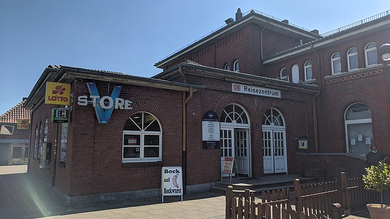
Photo: Clic, CC BY-SA 4.0.
Bremen-Vegesack is a railway station serving the Vegesack district of Bremen. The station is part of the Bremen-Farge railway line served by Bremen S-Bahn line RS1, operated by NordWestBahn.
Places in the Area
Nearby places include Grohner Düne and Bremen-Vegesack.

Bremen-Vegesack
Suburb

Photo: Dtuk, CC BY-SA 3.0.
Vegesack is a northern district of Bremen, the capital of the German state Free Hanseatic City of Bremen.
Lemwerder
Town

Photo: Traveler100, CC BY-SA 3.0.
Lemwerder is a municipality in the district of Wesermarsch, in Lower Saxony, Germany. It is on the left bank of the Weser, approximately 27 kilometres east of Oldenburg, and 17 kilometres northwest of the centre of Bremen.
Tauwerkquartier
- Type: Neighborhood
- Category: locality
- Location: Bremen, City state Bremen, Germany, Central Europe, Europe
- View on OpenStreetMap
Latitude
53.16533° or 53° 9′ 55″ northLongitude
8.64046° or 8° 38′ 26″ eastOpen location code
9F5C5J8R+45OpenStreetMap ID
node 8429394448OpenStreetMap feature
place=neighbourhood
This page is based on OpenStreetMap, Wikidata, and Wikimedia Commons.
We’d love your help improving our open data sources. Thank you for contributing.
Satellite Map
Discover Tauwerkquartier from above in high-definition satellite imagery.
Localities in the Area
Explore places such as Grohn and Friedrichsdorf.
Notable Places Nearby
Highlights include Turnhalle Am Grohner Schulhof 7 and Verein Wassersport e.V. Vegesack (VWV).
Germany: Must-Visit Destinations
Delve into Berlin, Munich, Hamburg, and Frankfurt.
Curious Neighborhoods to Discover
Uncover intriguing neighborhoods from every corner of the globe.
About Mapcarta. Data © OpenStreetMap contributors and available under the Open Database License". Text is available under the CC BY-SA 4.0 license, except for photos, directions, and the map. Photo: Dschwen, CC BY-SA 3.0.