Centre Hospitalier Alliance
Centre Hospitalier Alliance is a hospital in Kinshasa, DR Congo. Centre Hospitalier Alliance is situated nearby to the university Institut supérieur de techniques appliquées, as well as near the hospital Hôpital CMOA Force Navale.| Tap on a place to explore it |
Places of Interest Nearby
Highlights include Kinshasa N’Dolo Airport and Stade des Martyrs.
Kinshasa N’Dolo Airport
Aerodrome

Photo: Kakane57, CC BY-SA 3.0.
N'Dolo Airport, also known as Ndolo Airport, is a secondary airport in the city of Kinshasa, Democratic Republic of the Congo, located in the commune of Barumbu near the city center.
Stade des Martyrs
Stadium
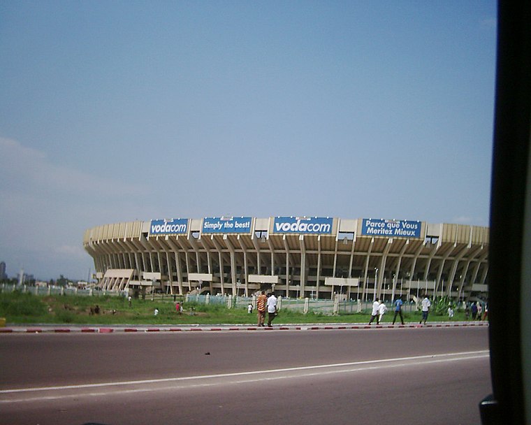
Photo: Vberger, Public domain.
The Pentecost Martyrs Stadium, commonly referred to as the Stade des Martyrs and formerly known as Stade Kamanyola, is a national multi-purpose stadium of the Democratic Republic of the Congo, located in Lingwala, Kinshasa. Stade des Martyrs is situated 2½ km west of Centre Hospitalier Alliance.
Stade Cardinal Malula
Stadium

Photo: Wikimedia, Public domain.
Stade Cardinal Malula, formerly known as Stade 24 Novembre and before Stade Reine Astrid, is a stadium located in Kinshasa, Democratic Republic of the Congo. Stade Cardinal Malula is situated 2½ km west of Centre Hospitalier Alliance.
Places in the Area
Nearby places include Kinshasa and Brazzaville.
Kinshasa

Photo: Antoine Moens de Hase, CC BY 2.0.
Kinshasa is the capital of the Democratic Republic of the Congo. It faces Brazzaville, the capital of the neighbouring Republic of the Congo, which can be seen in the distance across the wide Congo River.
Brazzaville

Photo: Prével EPOTA, CC BY-SA 4.0.
Brazzaville is the capital of the Republic of Congo, and serves as the financial and administrative center of the country. It can be a pleasant stopover to Pointe Noire or visits to the Congolese rain forests.
Centre Hospitalier Alliance
- Type: Hospital
- Category: health care
- Location: Kinshasa, Kinshasa City, DR Congo, Central Africa, Africa
- View on OpenStreetMap
Latitude
-4.32199° or 4° 19′ 19″ southLongitude
15.33325° or 15° 19′ 60″ eastOpen location code
6F7QM8HM+68OpenStreetMap ID
node 8474773717OpenStreetMap feature
amenity=hospital
This page is based on OpenStreetMap, Wikidata, and Wikimedia Commons.
We’d love your help improving our open data sources. Thank you for contributing.
Satellite Map
Discover Centre Hospitalier Alliance from above in high-definition satellite imagery.
Notable Places Nearby
Highlights include Institut supérieur de techniques appliquées and Hôpital CMOA Force Navale.
Nearby Places
Explore places such as CERERK and Centre hospitalier Alliance.
DR Congo: Must-Visit Destinations
Delve into Kinshasa, Lubumbashi, Virunga National Park, and Goma.
Curious Places to Discover
Uncover intriguing places from every corner of the globe.
About Mapcarta. Data © OpenStreetMap contributors and available under the Open Database License". Text is available under the CC BY-SA 4.0 license, except for photos, directions, and the map. Photo: Bergeycm, CC BY-SA 3.0.