Wanderwege Himmelpforten
Wanderwege Himmelpforten is in Himmelpforten, Stade, Lower Saxony. Wanderwege Himmelpforten is situated nearby to the fire station Freiwillige Feuerwehr, as well as near the park Marktplatz.| Tap on a place to explore it |
Places of Interest Nearby
Highlights include St. Mary’s Church and Wehbers Mühle.
St. Mary’s Church
Church
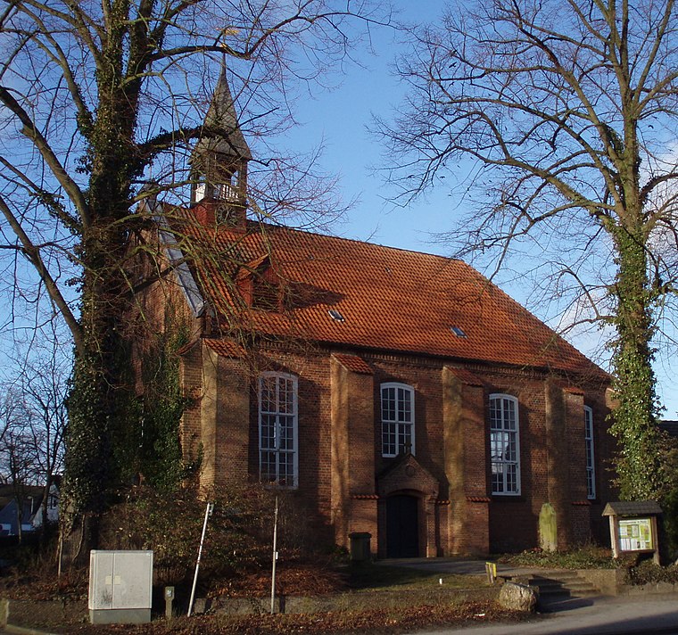
Photo: Morn the Gorn, CC BY-SA 3.0.
The Saint Mary's Church is a Lutheran parish church used and owned by the Lutheran parish in Himmelpforten, Lower Saxony, Germany. The Himmelpforten parish forms part of the Stade deanery within the Stade diocese of the Lutheran Church of Hanover. St. Mary’s Church is situated 320 metres west of Wanderwege Himmelpforten.
Wehbers Mühle
Windmill
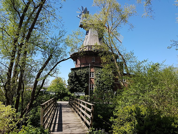
Photo: Tessa206, CC BY-SA 4.0.
Wehbers Mühle is a windmill, which is situated 510 metres west of Wanderwege Himmelpforten.
Porta-Coeli-Schule
School

Photo: Ulf Heinsohn, CC BY-SA 4.0.
Porta-Coeli-Schule is a school, which is situated 1 km northeast of Wanderwege Himmelpforten.
Places in the Area
Nearby places include Kuhla and Burweg.

Burweg
Village

Photo: Tadü, CC BY-SA 4.0.
Burweg is a municipality in the district of Stade, Lower Saxony, Germany. Burweg is situated 3 km northwest of Wanderwege Himmelpforten.
Breitenwisch
Village

Photo: Tadü, CC BY-SA 4.0.
Breitenwisch is a village, which is situated 3 km north of Wanderwege Himmelpforten.
Wanderwege Himmelpforten
- Type: Map
- Categories: information and tourism
- Location: Himmelpforten, Stade, Lower Saxony, Germany, Central Europe, Europe
- View on OpenStreetMap
Latitude
53.61435° or 53° 36′ 52″ northLongitude
9.30964° or 9° 18′ 35″ eastOpen location code
9F5FJ875+PVOpenStreetMap ID
node 847712944OpenStreetMap feature
tourism=information
This page is based on OpenStreetMap, Wikidata, and Wikimedia Commons.
We’d love your help improving our open data sources. Thank you for contributing.
Satellite Map
Discover Wanderwege Himmelpforten from above in high-definition satellite imagery.
Notable Places Nearby
Highlights include Freiwillige Feuerwehr and Marktplatz.
Nearby Places
Explore places such as Cafe Manaia and Markthalle.
Lower Saxony: Must-Visit Destinations
Delve into Hanover, Göttingen, Brunswick, and Wolfsburg.
Curious Places to Discover
Uncover intriguing places from every corner of the globe.
About Mapcarta. Data © OpenStreetMap contributors and available under the Open Database License". Text is available under the CC BY-SA 4.0 license, except for photos, directions, and the map. Photo: Danapit, CC BY-SA 3.0.