Hoffstatt
Hoffstatt is a farm in Baltmannsweiler, Landkreis Esslingen, Baden-Württemberg. Hoffstatt is situated nearby to the public building Bürgerhaus, as well as near the library Ortsbibliothek Hohengehren.| Tap on a place to explore it |
Places of Interest Nearby
Highlights include Aegidiuskirche and Rathaus Baltmannsweiler.
Aegidiuskirche
Church

Photo: MTheiler, CC BY-SA 4.0.
Aegidiuskirche is a church, which is situated 1½ km south of Hoffstatt.
Rathaus Baltmannsweiler
Town hall
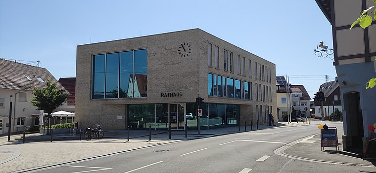
Photo: MTheiler, CC BY-SA 4.0.
Rathaus Baltmannsweiler is a town hall, which is situated 1½ km south of Hoffstatt.
Places in the Area
Nearby places include Schnait and Winterbach.
Schnait
Village
Schnait is a town district or Stadtteil within the town of Weinstadt in Rems-Murr district, Baden-Württemberg, Germany. Schnait was first mentioned in 1238 as Snait. Schnait is situated 5 km northwest of Hoffstatt.
Winterbach
Village
 Winterbach is a municipality in the district of Rems-Murr in Baden-Württemberg in Germany. Winterbach is situated 5 km northeast of Hoffstatt.
Deizisau
Village
 Deizisau is a town in the district of Esslingen in Baden-Württemberg in southern Germany. It belongs to the Stuttgart Region and the Stuttgart Metropolitan Region. Deizisau is situated 7 km southwest of Hoffstatt.
Hoffstatt
- Type: Farm
- Categories: locality and agriculture
- Location: Baltmannsweiler, Landkreis Esslingen, Stuttgart, Baden-Württemberg, Germany, Central Europe, Europe
- View on OpenStreetMap
Latitude
48.75646° or 48° 45′ 23″ northLongitude
9.44636° or 9° 26′ 47″ eastOpen location code
8FWFQC4W+HGOpenStreetMap ID
node 8489569810OpenStreetMap feature
place=farm
This page is based on OpenStreetMap, Wikidata, and Wikimedia Commons.
We’d love your help improving our open data sources. Thank you for contributing.
Satellite Map
Discover Hoffstatt from above in high-definition satellite imagery.
Notable Places Nearby
Highlights include Bürgerhaus and Ortsbibliothek Hohengehren.
Nearby Places
Explore places such as Geologie und Naherholung and Waldhorn.
Baden-Württemberg: Must-Visit Destinations
Delve into Stuttgart, Heidelberg, Karlsruhe, and Mannheim.
Curious Farms to Discover
Uncover intriguing farms from every corner of the globe.
About Mapcarta. Data © OpenStreetMap contributors and available under the Open Database License". Text is available under the CC BY-SA 4.0 license, except for photos, directions, and the map. Photo: Traveler100, CC BY-SA 3.0.