Dorfgemeinschaftsraum Roringen
Dorfgemeinschaftsraum Roringen is a community center in Göttingen, Southern Lower Saxony, Lower Saxony which is located on Lange Straße. Dorfgemeinschaftsraum Roringen is situated nearby to the fire station Freiwillige Feuerwehr Stadt Göttingen — Ortsfeuerwehr Roringen, as well as near St. Martin Kirche.| Tap on a place to explore it |
Places of Interest Nearby
Highlights include Bratental and Stadtwald Göttingen und Kerstlingeröder Feld.
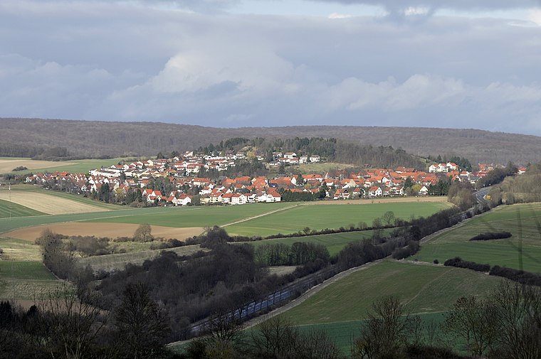
Bratental
Protected area

Photo: Dehio, CC BY-SA 3.0.
Bratental is a protected area, which is situated 1 km northwest of Dorfgemeinschaftsraum Roringen.
Stadtwald Göttingen und Kerstlingeröder Feld
Nature reserve

Photo: Dehio, CC BY-SA 3.0.
Stadtwald Göttingen und Kerstlingeröder Feld is a nature reserve.
Klosterkirche Nikolausberg
Church

Photo: Dehio, CC BY-SA 4.0.
Klosterkirche Nikolausberg is a church, which is situated 2 km west of Dorfgemeinschaftsraum Roringen.
Places in the Area
Nearby places include Roringen and Nikolausberg.
Roringen
Suburb
 Roringen is a village in the borough of Göttingen, Germany. High on a hill, it is separated from the city proper some 51⁄2 km to the south-west by farmlands and part of the Göttingen Forest.
Nikolausberg
Suburb

Photo: Forty2, CC BY-SA 3.0.
Nikolausberg is a northeastern borough of the university town of Göttingen, Germany. Its name derives from a legend according to which three pilgrims came to the church in 999 AD, of whom one left relics of Nicholas of Myra following his death there.
Herberhausen
Suburb

Photo: Dehio, CC BY-SA 3.0.
Herberhausen is a village belonging to Göttingen, Lower Saxony, in Germany.
Dorfgemeinschaftsraum Roringen
- Type: Community center
- Address: Lange Straße 4, Roringen, Göttingen, 37077
- Location: Göttingen, Göttingen, Southern Lower Saxony, Lower Saxony, Germany, Central Europe, Europe
- View on OpenStreetMap
Latitude
51.55779° or 51° 33′ 28″ northLongitude
10.00452° or 10° 0′ 16″ eastOpen location code
9F3GH253+4ROpenStreetMap ID
node 8558298830OpenStreetMap feature
amenity=community_centre
This page is based on OpenStreetMap, Wikidata, and Wikimedia Commons.
We’d love your help improving our open data sources. Thank you for contributing.
Satellite Map
Discover Dorfgemeinschaftsraum Roringen from above in high-definition satellite imagery.
Notable Places Nearby
Highlights include Freiwillige Feuerwehr Stadt Göttingen — Ortsfeuerwehr Roringen and St. Martin Kirche.
Nearby Places
Explore places such as Wandern in Göttingen and Rottenanger.
Southern Lower Saxony: Must-Visit Destinations
Delve into Goslar, Hamelin, Hann. Münden, and Einbeck.
Curious Community Centers to Discover
Uncover intriguing community centers from every corner of the globe.
About Mapcarta. Data © OpenStreetMap contributors and available under the Open Database License". Text is available under the CC BY-SA 4.0 license, except for photos, directions, and the map. Photo: Nastoshka, CC BY-SA 4.0.