Kindergarten Römerweg
Kindergarten Römerweg is a kindergarten in Wichtrach, Bern-Mittelland, Canton of Bern which is located on Römerweg. Kindergarten Römerweg is situated nearby to the church Kirche Wichtrach, as well as near the cemetery Friedhof Wichtrach.| Tap on a place to explore it |
Places of Interest Nearby
Highlights include Wichtrach railway station and Gerzensee.
Wichtrach railway station
Railway station
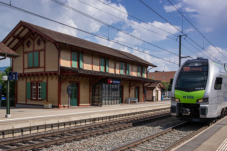
Photo: WillYs Fotowerkstatt, CC BY-SA 3.0.
Wichtrach railway station is a railway station in the municipality of Wichtrach, in the Swiss canton of Bern. It is an intermediate stop on the standard gauge Bern–Thun line of Swiss Federal Railways. Wichtrach railway station is situated 1 km southwest of Kindergarten Römerweg.
Gerzensee
Lake

Photo: User1977, CC BY-SA 3.0.
Gerzensee is a lake in canton of Bern, Switzerland. Its surface area is 25 ha. It gives the name to the village of Gerzensee. Gerzensee is situated 3 km southwest of Kindergarten Römerweg.
New château
Castle

Photo: Mike Switzerland, CC BY-SA 3.0.
New château is a castle, which is situated 2½ km west of Kindergarten Römerweg.
Places in the Area
Nearby places include Häutligen and Kiesen.
Häutligen
Village
Häutligen is a municipality in the Bern-Mittelland administrative district in the canton of Bern in Switzerland.
Kiesen
Village

Photo: WillYs Fotowerkstatt, CC BY 3.0.
Kiesen is a municipality in the Bern-Mittelland administrative district in the canton of Bern in Switzerland. Kiesen is situated 3 km south of Kindergarten Römerweg.
Herbligen
Village

Photo: Mmaegli, CC BY-SA 4.0.
Herbligen is a municipality in the Bern-Mittelland administrative district in the canton of Bern in Switzerland. Herbligen is situated 3 km southeast of Kindergarten Römerweg.
Kindergarten Römerweg
- Type: Kindergarten
- Address: Römerweg 6, Wichtrach, 3114
- Category: education
- Location: Wichtrach, Bern-Mittelland, Canton of Bern, Switzerland, Central Europe, Europe
- View on OpenStreetMap
Latitude
46.84478° or 46° 50′ 41″ northLongitude
7.5799° or 7° 34′ 48″ eastOpen location code
8FR9RHVH+WXOpenStreetMap ID
node 8575276977OpenStreetMap feature
amenity=kindergarten
This page is based on OpenStreetMap, Wikidata, and Wikimedia Commons.
We’d love your help improving our open data sources. Thank you for contributing.
Satellite Map
Discover Kindergarten Römerweg from above in high-definition satellite imagery.
Notable Places Nearby
Highlights include Kirche Wichtrach and Friedhof Wichtrach.
Nearby Places
Explore places such as Schulhaus Kirchstrasse and HeiMEDli Hausarztpraxis AG.
Switzerland: Must-Visit Destinations
Delve into Zurich, Berne, Geneva, and Basel.
Curious Kindergartens to Discover
Uncover intriguing kindergartens from every corner of the globe.
About Mapcarta. Data © OpenStreetMap contributors and available under the Open Database License". Text is available under the CC BY-SA 4.0 license, except for photos, directions, and the map. Photo: Simonizer, CC BY-SA 2.0 de.