Annexgårdens Gårdbutik
Annexgårdens Gårdbutik is a farm shop in Holbæk Municipality, Region Zealand. Annexgårdens Gårdbutik is situated nearby to the forest Nørreskov, as well as near Mølleskov.| Tap on a place to explore it |
Places of Interest Nearby
Highlights include Skamstrup Church and Kongsdal.
Skamstrup Church
Church

Photo: Bococo, CC BY-SA 3.0.
Skamstrup Church is situated 2½ km north of Annexgårdens Gårdbutik.
Kongsdal
Manor estate

Photo: Ramblersen2, CC BY-SA 4.0.
Kongsdal is a manor house and estate located approximately 14 kilometres southwest of Holbaek, between Undløse and Mørkøv, Holbæk Municipality, some 60 km west of Copenhagen, Denmark. Kongsdal is situated 3½ km northeast of Annexgårdens Gårdbutik.
Places in the Area
Nearby places include Undløse and Mørkøv.
Undløse
Village

Photo: Godewind, CC BY-SA 3.0 de.
Undløse is the main village of Undløse Parish, located about 17 kilometres southwest of Holbæk in Holbæk municipality in northwestern Zealand, Denmark. Undløse is situated 6 km east of Annexgårdens Gårdbutik.
Mørkøv
Village
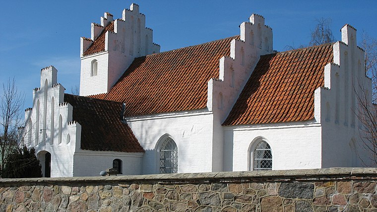
Photo: Hubertus, CC BY-SA 2.5.
Mørkøv is a railway town located in the northwestern part of the island of Zealand, Denmark. As of 1 January 2025, it has a population of 1,862. The town is located in Holbæk Municipality in Region Zealand. Mørkøv is situated 6 km north of Annexgårdens Gårdbutik.
Knabstrup
Village
Knabstrup is a small railway town, with a population of 1,103, at the railroad between Kalundborg and Holbæk in Holbæk Municipality, Region Zealand in Denmark. Knabstrup Manor, where the horse breed Knabstrupper was bred, is located two kilometres southeast of the town. Knabstrup is situated 8 km northeast of Annexgårdens Gårdbutik.
Annexgårdens Gårdbutik
- Type: Farm shop
- Also known as: “Hesselgårdens Gårdbutik”
- Categories: shop and food
- Location: Holbæk Municipality, Region Zealand, Denmark, Nordic countries, Europe
- View on OpenStreetMap
Latitude
55.60053° or 55° 36′ 2″ northLongitude
11.5004° or 11° 30′ 2″ eastOpen location code
9F7HJG22+65OpenStreetMap ID
node 8602474554OpenStreetMap feature
shop=farm
This page is based on OpenStreetMap, Wikidata, and Wikimedia Commons.
We’d love your help improving our open data sources. Thank you for contributing.
Satellite Map
Discover Annexgårdens Gårdbutik from above in high-definition satellite imagery.
Notable Places Nearby
Highlights include Nørreskov and Mølleskov.
Nearby Places
Explore places such as Annexgårdens Bosted and Dansbjerggård.
Denmark: Must-Visit Destinations
Delve into Copenhagen, Aarhus, Odense, and Aalborg.
Curious Farm Shops to Discover
Uncover intriguing farm shops from every corner of the globe.
About Mapcarta. Data © OpenStreetMap contributors and available under the Open Database License". Text is available under the CC BY-SA 4.0 license, except for photos, directions, and the map. Photo: Inkey, CC BY 2.0.