Plans du Quartier
Plans du Quartier is in Annemasse, Arrondissement of Saint-Julien-en-Genevois, Auvergne-Rhône-Alpes. Plans du Quartier is situated nearby to the tourism office Maison de la mobilité et du tourisme, as well as near the railway station Anemasse.| Tap on a place to explore it |
Places of Interest Nearby
Highlights include Annemasse station and Église réformée d’Annemasse.
Annemasse station
Station
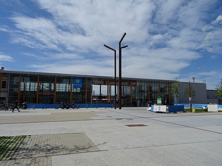
Photo: Remontees, CC BY-SA 4.0.
Annemasse station is a railway station located in Annemasse, Haute-Savoie, south-eastern France. The station was opened in 1880 and is located on the Aix-les-Bains–Annemasse railway, Longeray-Léaz-Le Bouveret railway, and CEVA orbital railway.
Église réformée d’Annemasse
Church

Photo: Lantus, CC BY-SA 3.0.
Église réformée d’Annemasse is a church, which is situated 440 metres south of Plans du Quartier.
Hôtel de Ville, Annemasse
Town hall

Photo: Ludo29, CC BY-SA 3.0.
The Hôtel de Ville is a municipal building in Annemasse, Haute-Savoie, eastern France, standing on Place de l'Hôtel de Ville. Hôtel de Ville, Annemasse is situated 690 metres south of Plans du Quartier.
Places in the Area
Nearby places include Puplinge and Presinge.
Puplinge
Village

Photo: Yann, CC BY-SA 4.0.
Puplinge is a municipality in the canton of Geneva in Switzerland.
Presinge
Village

Photo: Alexey M., CC BY-SA 4.0.
Presinge is a municipality of the canton of Geneva in Switzerland. Presinge is situated 2½ km northeast of Plans du Quartier.
Choulex
Village

Photo: Babsy, CC BY-SA 4.0.
Choulex is a municipality of the Canton of Geneva, Switzerland. Choulex is first mentioned in 1153 as Cholay. Choulex is situated 3 km north of Plans du Quartier.
Plans du Quartier
- Type: Map
- Categories: information and tourism
- Location: Annemasse, Arrondissement of Saint-Julien-en-Genevois, Haute-Savoie, Auvergne-Rhône-Alpes, France, Europe
- View on OpenStreetMap
Latitude
46.1992° or 46° 11′ 57″ northLongitude
6.23713° or 6° 14′ 14″ eastOperator
JCDecauxOpen location code
8FR856XP+MVOpenStreetMap ID
node 8623162567OpenStreetMap feature
tourism=information
This page is based on OpenStreetMap, Wikidata, and Wikimedia Commons.
We’d love your help improving our open data sources. Thank you for contributing.
Satellite Map
Discover Plans du Quartier from above in high-definition satellite imagery.
Notable Places Nearby
Highlights include Maison de la mobilité et du tourisme and Anemasse.
Nearby Places
Explore places such as Informations and Relay.
Haute-Savoie: Must-Visit Destinations
Delve into Chamonix, Annecy, Evian, and Megève.
Curious Places to Discover
Uncover intriguing places from every corner of the globe.
About Mapcarta. Data © OpenStreetMap contributors and available under the Open Database License". Text is available under the CC BY-SA 4.0 license, except for photos, directions, and the map. Photo: Ypsilon from Finland, CC0.