Ferme de Ceren - Espace Jean Piat
Ferme de Ceren - Espace Jean Piat is a community center in Chéreng, Arrondissement of Lille, Hauts-de-France. Ferme de Ceren - Espace Jean Piat is situated nearby to the police station Police municipale, as well as near the post office Bureau de Poste de Chereng.| Tap on a place to explore it |
Places of Interest Nearby
Highlights include Église Saint-Pierre de Tressin and Église Saint-Laurent d’Anstaing.
Église Saint-Pierre de Tressin
Church
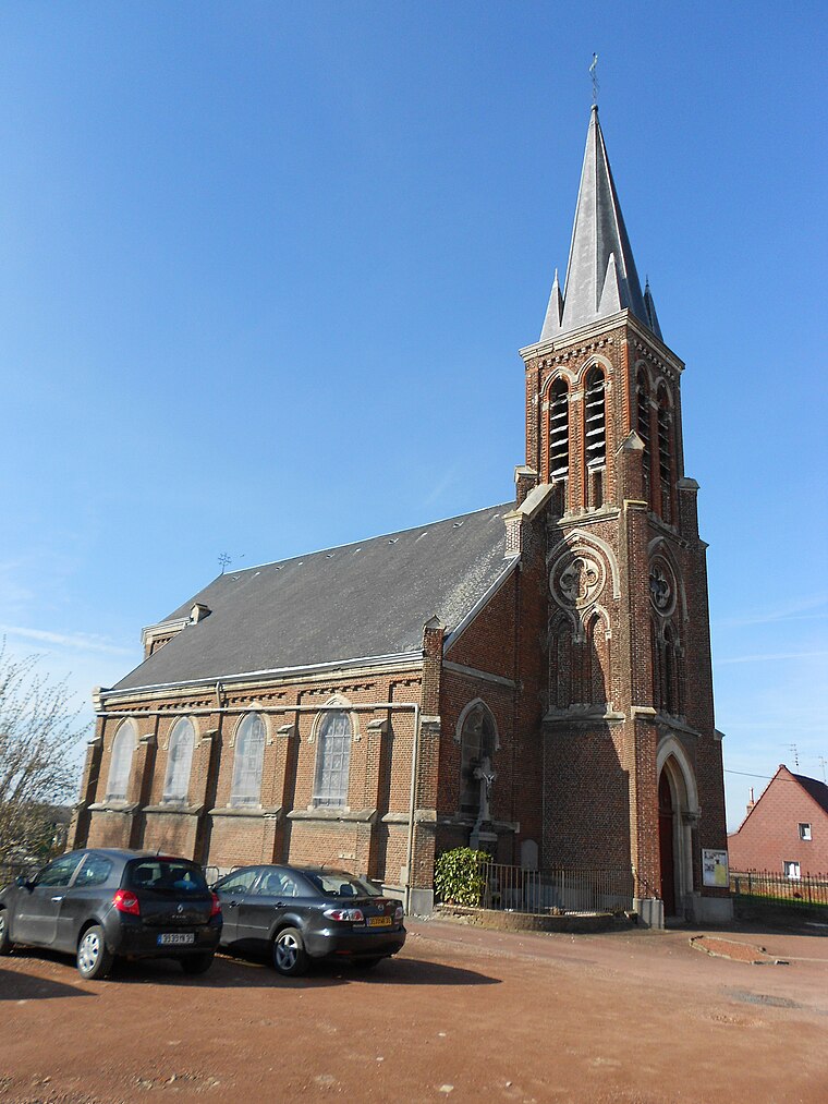
Photo: Codepem, CC BY-SA 3.0.
Église Saint-Pierre de Tressin is a church, which is situated 1 km northwest of Ferme de Ceren - Espace Jean Piat.
Église Saint-Laurent d’Anstaing
Church

Photo: Cbyd, CC BY-SA 3.0.
Église Saint-Laurent d’Anstaing is a church, which is situated 1 km southwest of Ferme de Ceren - Espace Jean Piat.
Église Notre-Dame-de-la-Visitation de Gruson (Nord)
Church

Photo: Codepem, CC BY-SA 3.0.
Église Notre-Dame-de-la-Visitation de Gruson (Nord) is a church, which is situated 2 km south of Ferme de Ceren - Espace Jean Piat.
Places in the Area
Nearby places include Haute Borne and Ascq.
Haute Borne
Suburb

Photo: Jiel, CC BY-SA 3.0.
Haute Borne is a new district of Villeneuve d'Ascq city, in France. It hosts the Haute Borne European scientific park. The aim of this area is to be home from high-tech companies and research and development centers, which can take advantage of laboratories and researchers of the University of Lille close to Haute Borne. Haute Borne is situated 3 km west of Ferme de Ceren - Espace Jean Piat.
Ascq
Quarter

Photo: Jiel, CC BY-SA 3.0.
Ascq is a former commune on the Marque river in the Nord department in northern France, seven kilometers from Belgium. Agricultural village until the Industrial Revolution, the former independent commune merged with others to become a district of the new town planned community of Villeneuve-d'Ascq since 1970. Ascq is situated 3 km west of Ferme de Ceren - Espace Jean Piat.
Carrefour de l’Arbre
Locality
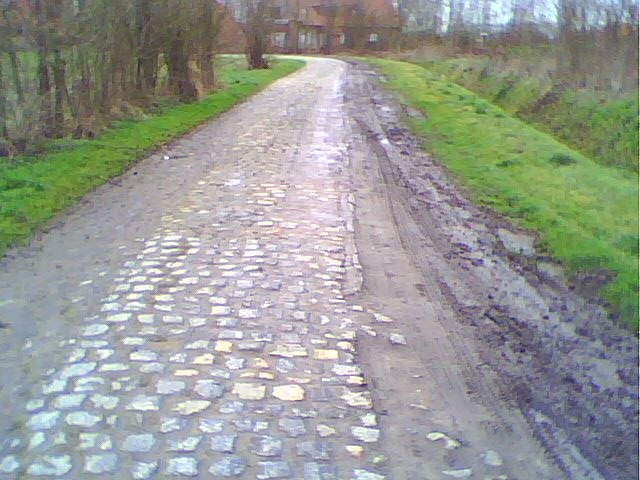
Photo: Wikimedia, CC BY-SA 3.0.
Carrefour de l'Arbre, officially Pavé de Luchin, is a 2.1 km cobbled road in the municipalities of Camphin-en-Pévèle, Baisieux-Sin and Gruson, in the Nord department of Northern France. Carrefour de l’Arbre is situated 3 km southeast of Ferme de Ceren - Espace Jean Piat.
Ferme de Ceren - Espace Jean Piat
- Type: Community center
- Location: Chéreng, Arrondissement of Lille, North, Hauts-de-France, France, Europe
- View on OpenStreetMap
Latitude
50.6111° or 50° 36′ 40″ northLongitude
3.20053° or 3° 12′ 2″ eastOpen location code
9F25J662+C6OpenStreetMap ID
node 8664579912OpenStreetMap feature
amenity=community_centre
This page is based on OpenStreetMap, Wikidata, and Wikimedia Commons.
We’d love your help improving our open data sources. Thank you for contributing.
Satellite Map
Discover Ferme de Ceren - Espace Jean Piat from above in high-definition satellite imagery.
Notable Places Nearby
Highlights include Police municipale and Bureau de Poste de Chereng.
Nearby Places
Explore places such as Pharmacie du Château and Renault.
Hauts-de-France: Must-Visit Destinations
Delve into Lille, Dunkirk, Calais, and Amiens.
Curious Community Centers to Discover
Uncover intriguing community centers from every corner of the globe.
About Mapcarta. Data © OpenStreetMap contributors and available under the Open Database License". Text is available under the CC BY-SA 4.0 license, except for photos, directions, and the map. Photo: LimoWreck, CC BY-SA 3.0.