Hügelgräberfeld von Höllriegelskreuth/Pullach
Hügelgräberfeld von Höllriegelskreuth/Pullach is an archaeological site in Grünwald, Munich, Bavaria. Hügelgräberfeld von Höllriegelskreuth/Pullach is situated nearby to the scenic viewpoint Blick auf Burg Grünwald, as well as near the stone Nagelfluhblöcke Pullach - Planet.| Tap on a place to explore it |
Places of Interest Nearby
Highlights include Höllriegelskreuth station and Grünwald Castle.
Höllriegelskreuth station
Railway station

Photo: Flummi-2011, CC BY-SA 3.0.
Höllriegelskreuth station is a railway station on the Munich S-Bahn in the district of Höllriegelskreuth, the industrial and business area of Pullach in the south area of Munich, Germany. It is served by the S-Bahn line S7 and S20. Höllriegelskreuth station is situated 470 metres southwest of Hügelgräberfeld von Höllriegelskreuth/Pullach.
Grünwald Castle
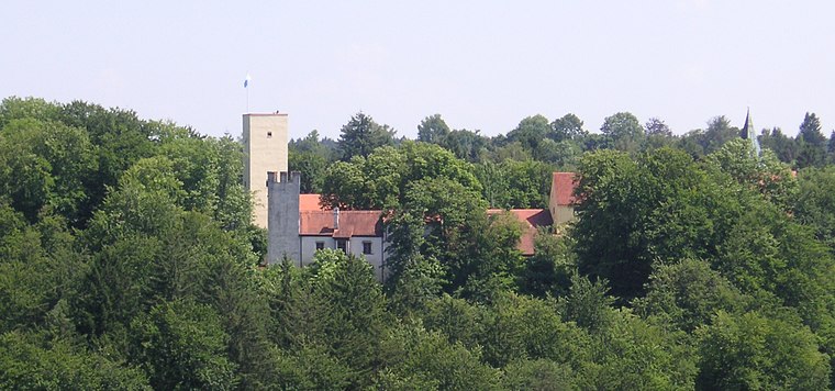
Photo: Wikimedia, CC BY-SA 3.0.
Grünwald Castle is a medieval hill castle in Grünwald, Bavaria. Grünwald Castle is situated 580 metres southeast of Hügelgräberfeld von Höllriegelskreuth/Pullach.
Grünwald Castle Museum
Museum

Photo: Rufus46, Public domain.
Grünwald Castle Museum is situated 600 metres southeast of Hügelgräberfeld von Höllriegelskreuth/Pullach.
Places in the Area
Nearby places include Höllriegelskreuth and Pullach.

Pullach
Village

Photo: Wikimedia, CC BY-SA 3.0.
Pullach, officially Pullach i. Isartal, is a municipality in the district of Munich in Bavaria in Germany. It lies on the Isar Valley Railway and is served by the S 7 line of the Munich S-Bahn, at the Großhesselohe Isartalbahnhof, Pullach and Höllriegelskreuth railway stations.
Grünwald
Town
Photo: Wikimedia, CC BY-SA 3.0.
Grünwald is a municipality in the district of Munich, in the state of Bavaria, Germany. It is located on the right bank of the Isar, 12 km southwest of Munich.
Hügelgräberfeld von Höllriegelskreuth/Pullach
- Type: Archaeological site
- Categories: historic site, tourist attraction, and tourism
- Location: Grünwald, Munich, Upper Bavaria, Bavaria, Germany, Central Europe, Europe
- View on OpenStreetMap
Latitude
48.04648° or 48° 2′ 47″ northLongitude
11.51369° or 11° 30′ 49″ eastOpen location code
8FWH2GW7+HFOpenStreetMap ID
node 8666952929OpenStreetMap feature
historic=archaeological_site
This page is based on OpenStreetMap, Wikidata, and Wikimedia Commons.
We’d love your help improving our open data sources. Thank you for contributing.
Satellite Map
Discover Hügelgräberfeld von Höllriegelskreuth/Pullach from above in high-definition satellite imagery.
Notable Places Nearby
Highlights include Blick auf Burg Grünwald and Nagelfluhblöcke Pullach - Planet.
Nearby Places
Explore places such as Grabhügelgruppe and Gabriel-von-Seidl-Denkmal.
Upper Bavaria: Must-Visit Destinations
Delve into Munich, Ingolstadt, Dachau, and Rosenheim.
Curious Archaeological Sites to Discover
Uncover intriguing archaeological sites from every corner of the globe.
About Mapcarta. Data © OpenStreetMap contributors and available under the Open Database License". Text is available under the CC BY-SA 4.0 license, except for photos, directions, and the map. Photo: Aconcagua, CC BY-SA 3.0.