Peney-le-Jorat, poste
Peney-le-Jorat, poste is a bus stop in Jorat-Menthue, Gros-de-Vaud District, Vaud and has an elevation of 841 metres. Peney-le-Jorat, poste is situated nearby to the village Villars-Mendraz, as well as near Villars-Tiercelin.| Tap on a place to explore it |
Places in the Area
Nearby places include Villars-Mendraz and Villars-Tiercelin.
Villars-Mendraz
Village
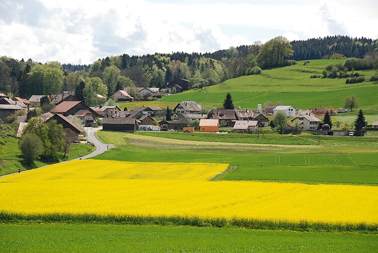
Photo: Flo1981, CC BY-SA 3.0.
Villars-Mendraz is a municipality in the district Gros-de-Vaud in the canton of Vaud in Switzerland. The municipalities of Villars-Tiercelin, Montaubion-Chardonney, Sottens, Villars-Mendraz and Peney-le-Jorat merged on 1 July 2011 into the new municipality of Jorat-Menthue.
Villars-Tiercelin
Village

Photo: Christophe95, CC BY-SA 3.0.
Villars-Tiercelin was a municipality in the district of Gros-de-Vaud in the canton of Vaud in Switzerland. The municipalities of Villars-Tiercelin, Montaubion-Chardonney, Sottens, Villars-Mendraz and Peney-le-Jorat merged on 1 July 2011 into the new municipality of Jorat-Menthue.
Dommartin
Village

Photo: Wikimedia, CC BY-SA 4.0.
Dommartin is a former municipality in the district of Gros-de-Vaud in the canton of Vaud in Switzerland. The municipalities of Dommartin, Naz, Poliez-le-Grand and Sugnens merged on 1 July 2011 into the new municipality of Montilliez. Dommartin is situated 2½ km northwest of Peney-le-Jorat, poste.
Peney-le-Jorat, poste
- Type: Bus stop
- Category: transportation
- Location: Jorat-Menthue, Gros-de-Vaud District, Vaud, Western Switzerland, Switzerland, Central Europe, Europe
- View on OpenStreetMap
Latitude
46.63279° or 46° 37′ 58″ northLongitude
6.72714° or 6° 43′ 38″ eastElevation
841 metres (2,759 feet)Operator
PAGOpen location code
8FR8JPMG+4VOpenStreetMap ID
node 8668021876OpenStreetMap feature
highway=bus_stopOpenStreetMap feature
public_transport=platform
This page is based on OpenStreetMap, Wikidata, and Wikimedia Commons.
We’d love your help improving our open data sources. Thank you for contributing.
Satellite Map
Discover Peney-le-Jorat, poste from above in high-definition satellite imagery.
Notable Places Nearby
Highlights include Salle communale and Gecko Escalade.
Nearby Places
Explore places such as Peney-le-Jorat, poste and Peney-le-Jorat, Chalet Renards.
Vaud: Must-Visit Destinations
Delve into Lausanne, Montreux, Nyon, and Vevey.
Curious Bus Stops to Discover
Uncover intriguing bus stops from every corner of the globe.
About Mapcarta. Data © OpenStreetMap contributors and available under the Open Database License". Text is available under the CC BY-SA 4.0 license, except for photos, directions, and the map. Photo: Annickjaquillard, CC BY-SA 4.0.