Valeyres Village
Valeyres Village is a bus stop in Valeyres-sous-Montagny, Jura-Nord vaudois District, Vaud. Valeyres Village is situated nearby to the castle Château Montagny-près-Yverdon, as well as near the railway stop Valeyres-sous-Montagny railway station.| Tap on a place to explore it |
Places of Interest Nearby
Highlights include Château Montagny-près-Yverdon and Valeyres-sous-Montagny railway station.
Château Montagny-près-Yverdon
Castle
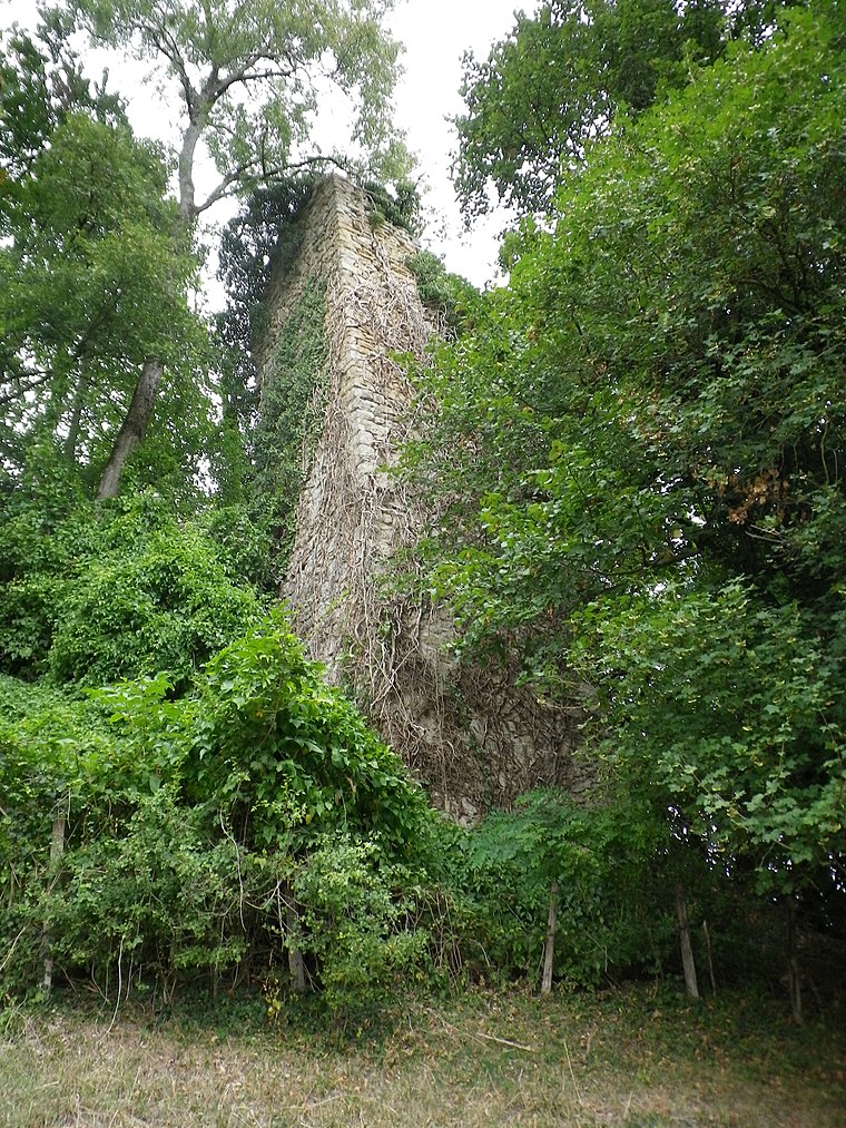
Photo: Nachosaurus, CC BY-SA 4.0.
Château Montagny-près-Yverdon is a castle, which is situated 270 metres south of Valeyres Village.
Valeyres-sous-Montagny railway station
Railway stop
Valeyres-sous-Montagny railway station is a railway station in the municipality of Valeyres-sous-Montagny, in the Swiss canton of Vaud. It is an intermediate stop and a request stop on the 1,000 mm gauge Yverdon–Ste-Croix line of Travys. Valeyres-sous-Montagny railway station is situated 310 metres southeast of Valeyres Village.
La Brinaz railway station
Railway stop
La Brinaz railway station is a railway station in the municipality of Montagny-près-Yverdon, in the Swiss canton of Vaud. It is an intermediate stop and a request stop on the 1,000 mm gauge Yverdon–Ste-Croix line of Travys. La Brinaz railway station is situated 1 km southeast of Valeyres Village.
Places in the Area
Nearby places include Montagny-près-Yverdon and Giez.
Montagny-près-Yverdon
Village

Photo: DidiWeidmann, CC BY-SA 3.0.
Montagny-près-Yverdon is a municipality in the district of Jura-Nord Vaudois of the canton of Vaud in Switzerland.
Giez
Village

Photo: Sinenomine2, CC BY-SA 3.0.
Giez is a municipality in the district of Jura-Nord Vaudois in the canton of Vaud in Switzerland.
Orges
Village

Photo: DidiWeidmann, CC BY-SA 3.0.
Orges is a municipality in the district of Jura-Nord Vaudois of the canton of Vaud in Switzerland.
Valeyres Village
- Type: Bus stop
- Category: transportation
- Location: Valeyres-sous-Montagny, Jura-Nord vaudois District, Vaud, Western Switzerland, Switzerland, Central Europe, Europe
- View on OpenStreetMap
Latitude
46.79921° or 46° 47′ 57″ northLongitude
6.60914° or 6° 36′ 33″ eastElevation
474 metres (1,555 feet)Operator
PAGNetwork
MobilisOpen location code
8FR8QJX5+MMOpenStreetMap ID
node 8684604518OpenStreetMap feature
highway=bus_stopOpenStreetMap feature
public_transport=platform
This page is based on OpenStreetMap, Wikidata, and Wikimedia Commons.
We’d love your help improving our open data sources. Thank you for contributing.
Satellite Map
Discover Valeyres Village from above in high-definition satellite imagery.
Notable Places Nearby
Highlights include Menhir de Crusilles-Dessus and Pierre à cupules.
Nearby Places
Explore places such as Centre sportif and Ferme Meylan.
Vaud: Must-Visit Destinations
Delve into Lausanne, Montreux, Nyon, and Vevey.
Curious Bus Stops to Discover
Uncover intriguing bus stops from every corner of the globe.
About Mapcarta. Data © OpenStreetMap contributors and available under the Open Database License". Text is available under the CC BY-SA 4.0 license, except for photos, directions, and the map. Photo: Annickjaquillard, CC BY-SA 4.0.