Cork City Council
Cork City Council is a government office in Cork, Munster which is located on Anglesea Street. Cork City Council is situated nearby to the town hall City Hall, as well as near Anglesea Street Fire Station.| Tap on a place to explore it |
Places of Interest Nearby
Highlights include City Hall and Clontarf Bridge.
City Hall
Town hall

Photo: KlausFoehl, CC BY-SA 3.0.
The City Hall, Cork is a civic building in Cork, Ireland which houses the administrative headquarters of Cork City Council.
Clontarf Bridge
Bridge

Photo: MonikaLisa2, CC BY-SA 4.0.
Clontarf Bridge is situated 160 metres north of Cork City Council.
South Infirmary-Victoria University Hospital
Hospital
The South Infirmary-Victoria University Hospital is an elective surgical hospital in Cork, County Cork, Ireland. It is part of the South/Southwest Hospital Group. South Infirmary-Victoria University Hospital is situated 350 metres south of Cork City Council.
Places in the Area
Nearby places include Turner’s Cross and Shandon.
Turner’s Cross
Suburb
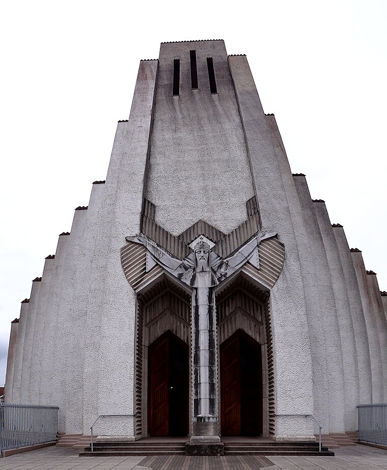
Photo: Uspn, CC BY-SA 3.0.
Turners Cross is a ward on the south side of Cork City in Ireland, and home to the Roman Catholic parish of the same name. Largely residential, one of the key features of the area is the iconic church created by architect Barry Byrne and sculptor John Storrs, the Church of Christ the King.
Shandon
Suburb

Photo: psyberartist, CC BY 2.0.
Shandon is a district on the north-side of Cork city. Shandon lies north of the River Lee and North Gate Bridge, the northernmost point of the medieval city.
Montenotte
Suburb

Photo: Podstawko, CC BY-SA 4.0.
Montenotte is an area in the northeast of Cork City, Ireland, which was home to merchants and a prosperous middle class from the early to mid-19th century.
Cork City Council
- Type: Government office
- Address: Anglesea Street, Cork, T12 T997
- Categories: office and government building
- Location: Cork, Munster, Ireland, Britain and Ireland, Europe
- View on OpenStreetMap
Latitude
51.89659° or 51° 53′ 48″ northLongitude
-8.46556° or 8° 27′ 56″ westOpen location code
9C3HVGWM+JQOpenStreetMap ID
node 8685638611OpenStreetMap feature
office=government
This page is based on OpenStreetMap, Wikidata, and Wikimedia Commons.
We’d love your help improving our open data sources. Thank you for contributing.
Satellite Map
Discover Cork City Council from above in high-definition satellite imagery.
Notable Places Nearby
Highlights include Anglesea Street Fire Station and Cork City Hall Gardens.
Nearby Places
Explore places such as Cork City Hall and Fireman’s Rest.
Ireland: Must-Visit Destinations
Delve into Dublin, Limerick, Galway, and Waterford.
Curious Government Offices to Discover
Uncover intriguing government offices from every corner of the globe.
About Mapcarta. Data © OpenStreetMap contributors and available under the Open Database License". Text is available under the CC BY-SA 4.0 license, except for photos, directions, and the map. Photo: psyberartist, CC BY 2.0.