Pr. Alexandre Herculano
Pr. Alexandre Herculano is a bus stop in Faro (Sé e São Pedro), Faro. Pr. Alexandre Herculano is situated nearby to the park Jardim Dr. Amadeu Ferreira de Almeida, as well as near the health club Contrology Pilates.| Tap on a place to explore it |
Places of Interest Nearby
Highlights include Palacete Belmarço and Faro Cathedral.
Palacete Belmarço
Museum
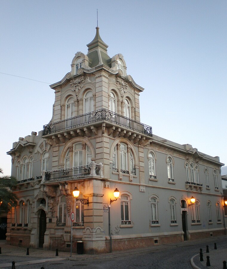
Photo: PauloMoreira, Public domain.
Palacete Belmarço is a museum, which is situated 190 metres southwest of Pr. Alexandre Herculano.
Faro Cathedral
Church

Photo: Abrget47j, CC BY-SA 3.0.
Faro Cathedral is a Roman Catholic cathedral in Faro, Portugal. The cathedral was consecrated in the name of the Blessed Virgin Mary in the late 13th century by the Archbishop of Braga. Faro Cathedral is situated 360 metres southwest of Pr. Alexandre Herculano.
Câmara Municipal de Faro
Town hall

Photo: Nol Aders, CC BY-SA 3.0.
Câmara Municipal de Faro is a town hall, which is situated 310 metres southwest of Pr. Alexandre Herculano.
Places in the Area
Nearby places include Pechão and Olhão.
Pechão
Village

Photo: Pedro S Bello, CC BY-SA 4.0.
Pechão is a Portuguese parish in the municipality of Olhão. The population in 2011 was 3,601, in an area of 19.79 km². Pechão is situated 7 km northeast of Pr. Alexandre Herculano.
Olhão

Photo: Creative Commons, CC BY-SA 4.0.
Olhão is a fishing port in the Algarve. Olhão is a major port and the largest fishing port in the Algarve. It is full of character with Moorish-style houses, an influence from the commercial links with Africa.
Pr. Alexandre Herculano
- Type: Bus stop
- Category: transportation
- Location: Faro (Sé e São Pedro), Faro, Faro District, Algarve, Portugal, Iberia, Europe
- View on OpenStreetMap
Latitude
37.01547° or 37° 0′ 56″ northLongitude
-7.93162° or 7° 55′ 54″ westOpen location code
8C9J2389+59OpenStreetMap ID
node 8719667631OpenStreetMap feature
highway=bus_stopOpenStreetMap feature
public_transport=platform
This page is based on OpenStreetMap, Wikidata, and Wikimedia Commons.
We’d love your help improving our open data sources. Thank you for contributing.
Satellite Map
Discover Pr. Alexandre Herculano from above in high-definition satellite imagery.
Notable Places Nearby
Highlights include Jardim Dr. Amadeu Ferreira de Almeida and Contrology Pilates.
Nearby Places
Explore places such as Urbinvest and GAES.
Algarve: Must-Visit Destinations
Delve into Portimão, Lagos, Tavira, and Albufeira.
Curious Bus Stops to Discover
Uncover intriguing bus stops from every corner of the globe.
About Mapcarta. Data © OpenStreetMap contributors and available under the Open Database License". Text is available under the CC BY-SA 4.0 license, except for photos, directions, and the map. Photo: Inkey, CC BY-SA 2.0.