Schortewitz cist
Schortewitz cist is an archaeological site in Köthen, Anhalt-Bitterfeld, Saxony-Anhalt. Schortewitz cist is situated nearby to Naumann-Museum, as well as near Schloss Köthen.| Tap on a place to explore it |
Places of Interest Nearby
Highlights include Schloss Köthen and Schloss- und Pfarrkirche St. Mariä Himmelfahrt.
Schloss Köthen

Photo: Oursana, Public domain.
Schloss Köthen is a palace in Köthen, Germany. Begun as a castle, it was protected by a moat. It was the residence of the Princes and Dukes of Anhalt from 1244 to 1847, and now belongs to a foundation for the preservation of sites in Saxony-Anhalt.
Schloss- und Pfarrkirche St. Mariä Himmelfahrt
Church

Photo: Wikimedia, CC BY-SA 3.0.
Schloss- und Pfarrkirche St. Mariä Himmelfahrt is a church, which is situated 220 metres west of Schortewitz cist.
Rathaus Köthen
Town hall

Photo: Michael Sander, CC BY-SA 3.0.
Rathaus Köthen is a town hall, which is situated 330 metres southwest of Schortewitz cist.
Places in the Area
Nearby places include Großpaschleben and Thurau.
Großpaschleben
Village

Photo: Jwaller, CC BY-SA 3.0.
Großpaschleben is a village and a former municipality in the district of Anhalt-Bitterfeld, in Saxony-Anhalt, Germany. Since January 1, 2010, it is part of the municipality Osternienburger Land. Großpaschleben is situated 3 km west of Schortewitz cist.
Thurau
Hamlet
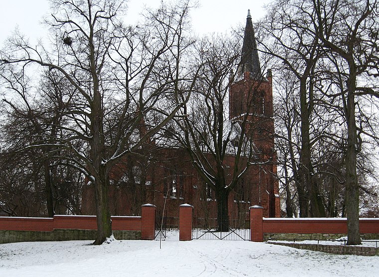
Photo: Sicherlich, CC BY 3.0.
Thurau is a hamlet, which is situated 4 km northwest of Schortewitz cist.
Mölz
Hamlet

Photo: Jwaller, CC BY-SA 4.0.
Mölz is a hamlet, which is situated 7 km west of Schortewitz cist.
Schortewitz cist
- Type: Archaeological site
- Description: megalithic tomb in Köthen, Germany
- Categories: cist, historic site, tourist attraction, and tourism
- Location: Köthen, Anhalt-Bitterfeld, Saxony-Anhalt, Germany, Central Europe, Europe
- View on OpenStreetMap
Latitude
51.75406° or 51° 45′ 15″ northLongitude
11.97737° or 11° 58′ 39″ eastOpen location code
9F3HQX3G+JWOpenStreetMap ID
node 8727871591OpenStreetMap feature
historic=archaeological_siteWikidata ID
Q2796698
This page is based on OpenStreetMap, Wikidata, and Wikimedia Commons.
We’d love your help improving our open data sources. Thank you for contributing.
Satellite Map
Discover Schortewitz cist from above in high-definition satellite imagery.
In Other Languages
“Schortewitz cist” goes by many names.
- German: “Rampenkiste von Schortewitz”
Notable Places Nearby
Highlights include Naumann-Museum and Spielplatz Schlosspark.
Nearby Places
Explore places such as AADe Atelier für Architektur & Denkmalpflege and Ludwigsbau.
Saxony-Anhalt: Must-Visit Destinations
Delve into Magdeburg, Halle, Wittenberg, and Quedlinburg.
Curious Archaeological Sites to Discover
Uncover intriguing archaeological sites from every corner of the globe.
About Mapcarta. Data © OpenStreetMap contributors and available under the Open Database License". Text is available under the CC BY-SA 4.0 license, except for photos, directions, and the map. Photo: Sicherlich, CC BY 2.5.