Modehaus gerken
Modehaus gerken is a clothing store in Himmelpforten, Stade, Lower Saxony. Modehaus gerken is situated nearby to the school Grundschule Himmelpforten, as well as near St. Mary’s Church.| Tap on a place to explore it |
Places of Interest Nearby
Highlights include St. Mary’s Church and Wehbers Mühle.
St. Mary’s Church
Church
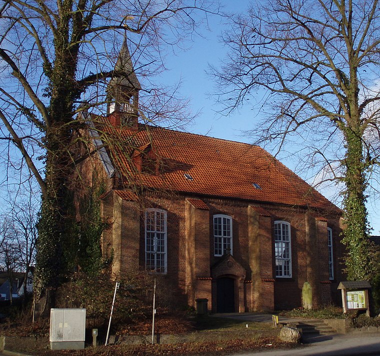
Photo: Morn the Gorn, CC BY-SA 3.0.
The Saint Mary's Church is a Lutheran parish church used and owned by the Lutheran parish in Himmelpforten, Lower Saxony, Germany. The Himmelpforten parish forms part of the Stade deanery within the Stade diocese of the Lutheran Church of Hanover. St. Mary’s Church is situated 200 metres southwest of Modehaus gerken.
Wehbers Mühle
Windmill
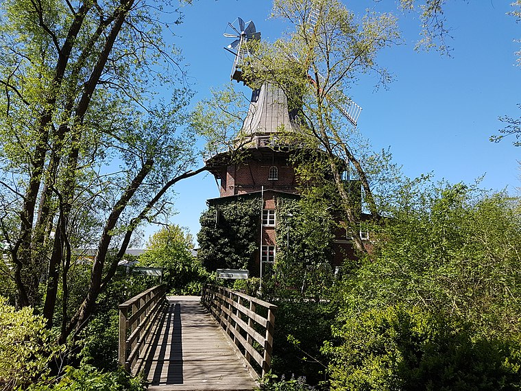
Photo: Tessa206, CC BY-SA 4.0.
Wehbers Mühle is a windmill, which is situated 290 metres west of Modehaus gerken.
Himmelpforten station
Railway stop

Photo: Raboe001, CC BY-SA 3.0.
Himmelpforten station is a railway stop, which is situated 1 km northeast of Modehaus gerken.
Places in the Area
Nearby places include Kuhla and Burweg.

Burweg
Village

Photo: Tadü, CC BY-SA 4.0.
Burweg is a municipality in the district of Stade, Lower Saxony, Germany. Burweg is situated 2½ km west of Modehaus gerken.
Breitenwisch
Village

Photo: Tadü, CC BY-SA 4.0.
Breitenwisch is a village, which is situated 3 km north of Modehaus gerken.
Modehaus gerken
- Opening hours:
Monday—Friday: 9:00 AM—6:30 PM
Saturday: 9:00 AM—1:00 PM
public holidays and Sunday: closed - Type: Clothing store
- Category: shop
- Location: Himmelpforten, Stade, Lower Saxony, Germany, Central Europe, Europe
- View on OpenStreetMap
Latitude
53.61602° or 53° 36′ 58″ northLongitude
9.30642° or 9° 18′ 23″ eastOpen location code
9F5FJ884+CHOpenStreetMap ID
node 8745862382OpenStreetMap feature
shop=clothes
This page is based on OpenStreetMap, Wikidata, and Wikimedia Commons.
We’d love your help improving our open data sources. Thank you for contributing.
Satellite Map
Discover Modehaus gerken from above in high-definition satellite imagery.
Notable Places Nearby
Highlights include Grundschule Himmelpforten and Villa von Issendorff.
Nearby Places
Explore places such as Praxis für Physiotherapie Heiduczek and IntensivHelden.
Lower Saxony: Must-Visit Destinations
Delve into Hanover, Göttingen, Brunswick, and Wolfsburg.
Curious Clothing Stores to Discover
Uncover intriguing clothing stores from every corner of the globe.
About Mapcarta. Data © OpenStreetMap contributors and available under the Open Database License". Text is available under the CC BY-SA 4.0 license, except for photos, directions, and the map. Photo: Danapit, CC BY-SA 3.0.