Pest Vármegyei Kormányhivatal
Pest Vármegyei Kormányhivatal is a government office in Budapest, Central Hungary which is located on Városház utca. Pest Vármegyei Kormányhivatal is situated nearby to the government office Pest Vármegyei Önkormányzati Hivatal, as well as near the fountain Vízjáték.| Tap on a place to explore it |
- Email: hivatal@pest.gov.hu
- Type: Government office
- Address: Városház utca 7, Budapest, 1052
Places of Interest Nearby
Highlights include Dohány Street Synagogue and Peter of Alcantara Church, Budapest.
Dohány Street Synagogue
Synagogue

Photo: OsvátA, CC BY-SA 3.0.
The Dohány Street Synagogue, also known as the Great Synagogue or Tabakgasse Synagogue, is a Neolog Jewish congregation and synagogue, located on Dohány Street in Erzsébetváros of Budapest, Hungary. Dohány Street Synagogue is situated 380 metres northeast of Pest Vármegyei Kormányhivatal.
Peter of Alcantara Church, Budapest
Church
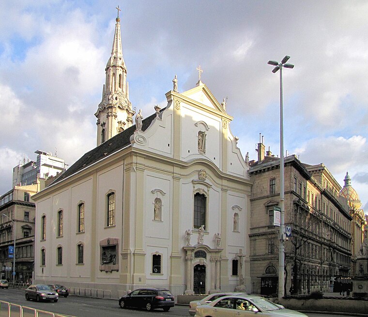
Photo: KovacsDaniel, CC BY-SA 3.0.
Peter of Alcantara Church, Budapest is situated 140 metres south of Pest Vármegyei Kormányhivatal.
ELTE University Library
Library

Photo: Misibacsi, CC BY-SA 3.0.
ELTE University Library is situated 220 metres south of Pest Vármegyei Kormányhivatal.
Places in the Area
Nearby places include Pest and Belváros.
Pest
Suburb

Photo: AlasdairW, CC BY-SA 3.0.
Pest is the part of Budapest, the capital city of Hungary, that lies on the eastern bank of the Danube. Pest was administratively unified with Buda and Óbuda in 1873.
Belváros

Photo: Wikimedia, CC BY-SA 3.0.
Belváros or Downtown is the V. District of Budapest. It consists of two historic neighbourhoods with well-defined borders within the V. District - Lipótváros in the north includes the Parliament and many governmental buildings, Szent István Basilica and some museums, while the southern part is mostly high-class accommodations, shops and nightlife area.
Budapest’s Palace District
Suburb
Budapest's Palotanegyed forms an inner part of Pest, the eastern half of Budapest. Known until the communist period as the ‘Magnates’ Quarter’, it consists of the most westerly part of the city's Eighth District, or Józsefváros, which was named on 7 November 1777 after Joseph II, Holy Roman Emperor and Archduke of Austria, who reigned 1765-1790.
Pest Vármegyei Kormányhivatal
- Categories: office and government building
- Location: Budapest, Central Hungary, Hungary, Central Europe, Europe
- View on OpenStreetMap
Latitude
47.49442° or 47° 29′ 40″ northLongitude
19.05618° or 19° 3′ 22″ eastOpen location code
8FVXF3V4+QFOpenStreetMap ID
node 8842402424OpenStreetMap feature
office=government
This page is based on OpenStreetMap, Wikidata, and Wikimedia Commons.
We’d love your help improving our open data sources. Thank you for contributing.
Satellite Map
Discover Pest Vármegyei Kormányhivatal from above in high-definition satellite imagery.
Notable Places Nearby
Highlights include Pest Vármegyei Önkormányzati Hivatal and Vízjáték.
Nearby Places
Explore places such as Műemlék and itthome.hu.
Budapest: Must-Visit Destinations
Delve into Belváros, Víziváros, Óbuda, and East Pest.
Curious Government Offices to Discover
Uncover intriguing government offices from every corner of the globe.
About Mapcarta. Data © OpenStreetMap contributors and available under the Open Database License". Text is available under the CC BY-SA 4.0 license, except for photos, directions, and the map. Photo: Chmehl, CC BY 3.0.