Bicycle repair station
Bicycle repair station is a bicycle repair station in Lungern, Obwalden. Bicycle repair station is situated nearby to the scenic viewpoint Käppeli, as well as near the climbing site Klettergarten Lungern.| Tap on a place to explore it |
Places of Interest Nearby
Highlights include Sacred Heart parish church with terraced cemetery and Lungern railway station.
Sacred Heart parish church with terraced cemetery
Church

Photo: Haecki Ursula, CC BY-SA 3.0.
Sacred Heart parish church with terraced cemetery is situated 1 km north of Bicycle repair station.
Lungern railway station
Railway station
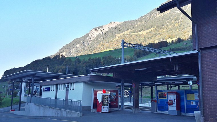 Lungern railway station is a Swiss railway station on the Brünig line, owned by the Zentralbahn, that links Interlaken and Lucerne. The station is located in the municipality of Lungern and the canton of Obwalden. Lungern railway station is situated 1½ km northeast of Bicycle repair station.
Old church tower, entrance to the village (late Romanesque tower of the old church)
Tower

Photo: Tschubby, CC BY-SA 3.0.
Old church tower, entrance to the village (late Romanesque tower of the old church) is situated 2 km north of Bicycle repair station.
Places in the Area
Nearby places include Obsee and Lungern.

Lungern
Village

Photo: Zuphilip, Copyrighted free use.
Lungern is a municipality in the canton of Obwalden in Switzerland. It encompasses Lake Lungern and, besides the village of Lungern, the settlements of Bürglen, Kaiserstuhl and Obsee.
Brienzwiler
Village

Photo: Wikimedia, CC BY-SA 3.0.
Brienzwiler is a municipality in the Interlaken-Oberhasli administrative district in the canton of Bern in Switzerland. Besides the village of Brienzwiler, the municipality also includes the settlement of Balmhof. Brienzwiler is situated 5 km southwest of Bicycle repair station.
Bicycle repair station
- Type: Bicycle repair station
- Category: transportation
- Location: Lungern, Obwalden, Canton of Obwalden, Switzerland, Central Europe, Europe
- View on OpenStreetMap
Latitude
46.77486° or 46° 46′ 30″ northLongitude
8.15569° or 8° 9′ 21″ eastOpen location code
8FRCQ5F4+W7OpenStreetMap ID
node 8867331889OpenStreetMap feature
amenity=bicycle_repair_station
This page is based on OpenStreetMap, Wikidata, and Wikimedia Commons.
We’d love your help improving our open data sources. Thank you for contributing.
Satellite Map
Discover Bicycle repair station from above in high-definition satellite imagery.
Places with the Same Name
Discover other places named “Bicycle repair station”.
Notable Places Nearby
Highlights include Käppeli and Klettergarten Lungern.
Nearby Places
Explore places such as Burgkapelle and Bergrestaurant Käppeli.
Switzerland: Must-Visit Destinations
Delve into Zurich, Berne, Geneva, and Basel.
Curious Bicycle Repair Stations to Discover
Uncover intriguing bicycle repair stations from every corner of the globe.
About Mapcarta. Data © OpenStreetMap contributors and available under the Open Database License". Text is available under the CC BY-SA 4.0 license, except for photos, directions, and the map. Photo: Simonizer, CC BY-SA 2.0 de.