Zdravstveni dom AQI
Zdravstveni dom AQI is a monitoring station in Kranj, Central Slovenia. Zdravstveni dom AQI is situated nearby to Bleiweisov park, as well as near the hospital Kranj Community Health Centre.| Tap on a place to explore it |
Places of Interest Nearby
Highlights include Prešeren Grove and Slovene Square.
Prešeren Grove
Park

Photo: Meho29, CC BY-SA 3.0.
Prešeren Grove is a park, which is situated 480 metres southeast of Zdravstveni dom AQI.
Slovene Square
Square

Photo: Meho29, CC BY-SA 3.0.
Slovene Square is situated 540 metres south of Zdravstveni dom AQI.
Castle Khislstein
Castle
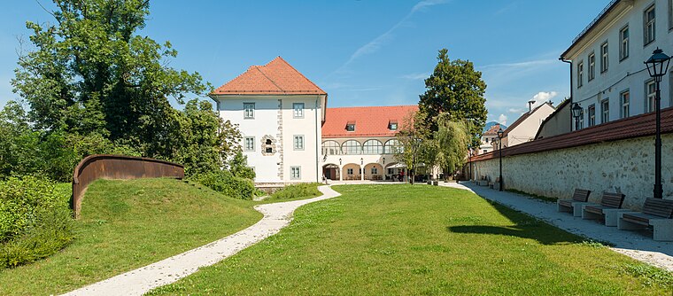
Photo: Meho29, CC BY-SA 4.0.
Kieselstein Castle, also known as Khislstein, is a 13th-century castle in the city of Kranj, in the Upper Carniola region of Slovenia. The castle stands at what was once a defensible point, guarding the city pier and crossing over the river Sava, and was predated on the site by a round 11th-century keep. Castle Khislstein is situated 1 km south of Zdravstveni dom AQI.
Places in the Area
Nearby places include Huje and Struževo.
Huje
Suburb
Huje is a former settlement in the Municipality of Kranj in the Upper Carniola region of Slovenia. It now corresponds to the neighborhood of Huje in Kranj.
Struževo
Suburb
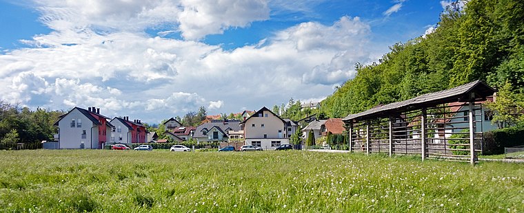
Photo: Kulmalukko, CC BY-SA 3.0.
Struževo is a former settlement in the Municipality of Kranj in the Upper Carniola region of Slovenia. It now corresponds to the neighborhood of Struževo in Kranj.
Rupa
Suburb

Photo: Vid Pogacnik, CC BY-SA 4.0.
Rupa is a former settlement in the Municipality of Kranj in the Upper Carniola region of Slovenia. It is now part of the city of Kranj.
Zdravstveni dom AQI
- Type: Monitoring station
- Location: Kranj, Central Slovenia, Slovenia, Central Europe, Europe
- View on OpenStreetMap
Latitude
46.24746° or 46° 14′ 51″ northLongitude
14.3533° or 14° 21′ 12″ eastOpen location code
8FRP69W3+X8OpenStreetMap ID
node 8879299568OpenStreetMap feature
man_made=monitoring_station
This page is based on OpenStreetMap, Wikidata, and Wikimedia Commons.
We’d love your help improving our open data sources. Thank you for contributing.
Satellite Map
Discover Zdravstveni dom AQI from above in high-definition satellite imagery.
Notable Places Nearby
Highlights include Bleiweisov park and Kranj Community Health Centre.
Nearby Places
Explore places such as Zobna poliklinika Kranj and Dr. Janez Bleiweis.
Central Slovenia: Must-Visit Destinations
Delve into Ljubljana, Škofja Loka, Kamnik, and Grosuplje.
Curious Monitoring Stations to Discover
Uncover intriguing monitoring stations from every corner of the globe.
About Mapcarta. Data © OpenStreetMap contributors and available under the Open Database License". Text is available under the CC BY-SA 4.0 license, except for photos, directions, and the map. Photo: Meho29, CC BY-SA 3.0.