Imkerei Klimm
Imkerei Klimm is a beekeeper in Berlin, Berlin which is located on Minorkaweg. Imkerei Klimm is situated nearby to the church Gemeindezentrum ev. Kirchengemeinde Rudow, as well as near the school Schliemann-Schule.| Tap on a place to explore it |
Places of Interest Nearby
Highlights include Naturdenkmal Rohrpfuhle and Rudow.
Naturdenkmal Rohrpfuhle
Pond

Photo: Frank schubert, CC BY-SA 4.0.
Naturdenkmal Rohrpfuhle is a pond, which is situated 800 metres east of Imkerei Klimm.
Rudow
Metro station
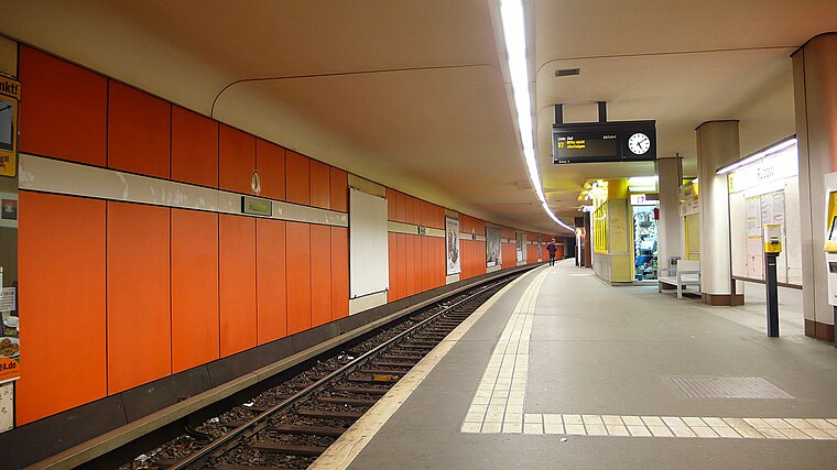
Photo: Phaeton1, CC BY-SA 3.0.
Rudow is a Berlin U-Bahn station located on the U7 line. There is a bus link to Berlin Schönefeld Airport, served by Line 171 and the express bus X7. Since 2015, the station has been under extended refurbishment to provide a better interchange between buses serving Brandenburg Airport/BER and the trains. Rudow is situated 1¼ km northeast of Imkerei Klimm.
Rudower Spinne
Square

Photo: Frank schubert, CC BY-SA 3.0.
Rudower Spinne is a square, which is situated 1¼ km northeast of Imkerei Klimm.
Places in the Area
Nearby places include Großziethen and Schönefeld.
Großziethen
Village

Photo: Hans G. Oberlack, CC BY-SA 4.0.
Großziethen is a village, which is situated 2½ km southwest of Imkerei Klimm.
Schönefeld
Town

Photo: Global Fish, CC BY-SA 4.0.
Schönefeld is a suburban municipality in the Dahme-Spreewald district, Brandenburg, Germany. It borders the southeastern districts of Berlin. The municipal area encompasses the old Berlin Schönefeld Airport and the new Berlin Brandenburg Airport. Schönefeld is situated 3 km southeast of Imkerei Klimm.
Kosmosviertel
Quarter

Photo: Fridolin freudenfett, CC BY-SA 3.0.
Kosmosviertel is a quarter, which is situated 3 km east of Imkerei Klimm.
Imkerei Klimm
- Type: Beekeeper
- Address: Minorkaweg 16A, Berlin, 12355
- Category: workshop
- Location: Berlin, Berlin, Stadt, Berlin, Germany, Central Europe, Europe
- View on OpenStreetMap
Latitude
52.41023° or 52° 24′ 37″ northLongitude
13.48137° or 13° 28′ 53″ eastOperator
Monika & Georg KlimmOpen location code
9F4MCF6J+3GOpenStreetMap ID
node 8900431905OpenStreetMap feature
craft=beekeeper
This page is based on OpenStreetMap, Wikidata, and Wikimedia Commons.
We’d love your help improving our open data sources. Thank you for contributing.
Satellite Map
Discover Imkerei Klimm from above in high-definition satellite imagery.
Notable Places Nearby
Highlights include Gemeindezentrum ev. Kirchengemeinde Rudow and Schliemann-Schule.
Nearby Places
Explore places such as Dedukt Beratung and Ascherslebener Weg.
Berlin: Must-Visit Destinations
Delve into Mitte, East Central, City West, and East Berlin.
Curious Beekeepers to Discover
Uncover intriguing beekeepers from every corner of the globe.
About Mapcarta. Data © OpenStreetMap contributors and available under the Open Database License". Text is available under the CC BY-SA 4.0 license, except for photos, directions, and the map. Photo: Berthold Werner, CC BY-SA 3.0.