Auxier United Methodist Church
Auxier United Methodist Church is a church in Floyd, Kentucky which is located on North River Street. Auxier United Methodist Church is situated nearby to Governors Cemetery, as well as near the hamlet Nero.| Tap on a place to explore it |
Places of Interest Nearby
Highlights include Highlands ARH Regional Medical Center and Paintsville-Prestonsburg-Combs Field.
Highlands ARH Regional Medical Center
Hospital
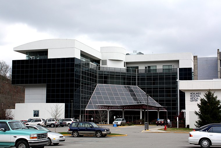
Photo: HiB2Bornot2B, Public domain.
Highlands ARH Regional Medical Center is a hospital in Prestonsburg, Kentucky. A 184-bed, nonprofit healthcare facility operated by Appalachian Regional Healthcare. it serves the counties of Floyd, Johnson, Martin, and Magoffin, a combined population of over 90,000. Highlands ARH Regional Medical Center is situated 1 mile southwest of Auxier United Methodist Church.
Paintsville-Prestonsburg-Combs Field
Aerodrome
Paintsville-Prestonsburg Combs Field is a publicly owned, private-use airport located four nautical miles southeast of the central business district of Paintsville, in Johnson County, Kentucky, United States.
Places in the Area
Nearby places include Auxier and Nero.
Auxier
Village
Auxier is an unincorporated community and census-designated place in Floyd County, Kentucky, United States. The 2010 United States Census reported that Auxier's population was 669, of which 661 persons were white and 2 persons were black.
Nero
Hamlet
Nero is an unincorporated community in Johnson County, Kentucky, United States. It is located at an elevation of 628 feet. Nero is located in the ZIP Code Tabulation Area for ZIP code 41265.
East Point
Hamlet
East Point is an unincorporated community in Johnson County, Kentucky, United States. The community's first settlers were the Matthias Harman, Greer and Auxier families at Blockhouse Bottom. East Point is situated 2 miles west of Auxier United Methodist Church.
Auxier United Methodist Church
- Type: Church
- Address: 88 North River Street, Auxier, KY 41602
- Categories: place of worship and religion
- Location: Floyd, Kentucky, South, United States, North America
- View on OpenStreetMap
Latitude
37.73748° or 37° 44′ 15″ northLongitude
-82.75793° or 82° 45′ 29″ westOpen location code
869VP6PR+XROpenStreetMap ID
node 8902450664OpenStreetMap feature
amenity=place_of_worship
This page is based on OpenStreetMap, Wikidata, and Wikimedia Commons.
We’d love your help improving our open data sources. Thank you for contributing.
Satellite Map
Discover Auxier United Methodist Church from above in high-definition satellite imagery.
Notable Places Nearby
Highlights include Governors Cemetery and Philadelphia Church.
Nearby Places
Explore places such as Family Dollar and Porter School.
Kentucky: Must-Visit Destinations
Delve into Frankfort, Louisville, Lexington, and Bowling Green.
Curious Churches to Discover
Uncover intriguing churches from every corner of the globe.
About Mapcarta. Data © OpenStreetMap contributors and available under the Open Database License". Text is available under the CC BY-SA 4.0 license, except for photos, directions, and the map. Photo: Wikimedia, CC BY-SA 2.0.