Klášter svaté Anežky české
Klášter svaté Anežky české is a monument in Šternberk, Olomouc District, Olomouc Region which is located on Opavská. Klášter svaté Anežky české is situated nearby to the church kaple sv. Anežky české, as well as near the museum Ecce Homo Park.| Tap on a place to explore it |
Places of Interest Nearby
Highlights include Augustinian monastery in Šternberk and Šternberk Castle.
Augustinian monastery in Šternberk
Monastery

Photo: Lehotsky, CC BY-SA 3.0.
Augustinian monastery in Šternberk is situated 160 metres north of Klášter svaté Anežky české.
Šternberk Castle
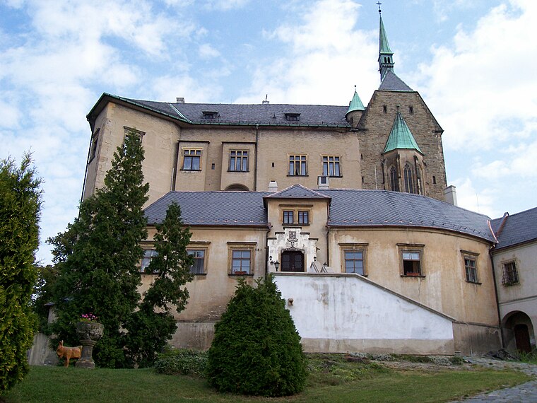
Photo: ToAr, CC BY-SA 4.0.
Šternberk Castle is situated 360 metres north of Klášter svaté Anežky české.
Church of the Annunciation
Church

Photo: Lehotsky, CC BY-SA 3.0.
Church of the Annunciation is situated 220 metres north of Klášter svaté Anežky české.
Places in the Area
Nearby places include Sternberk and Lipina.
Sternberk
Town

Photo: Pudelek, CC BY-SA 4.0.
Šternberk is a town in Olomouc District in the Olomouc Region of the Czech Republic. It has about 13,000 inhabitants. It is known for the Šternberk Castle. The historic town centre is well preserved and is protected as an urban monument zone.
Lipina
Village

Photo: Palickap, CC BY-SA 4.0.
Lipina is a municipality and village in Olomouc District in the Olomouc Region of the Czech Republic. It has about 200 inhabitants. Lipina lies approximately 18 kilometres north of Olomouc and 213 km east of Prague.
Hlásnice
Village

Photo: Palickap, CC BY-SA 4.0.
Hlásnice is a municipality and village in Olomouc District in the Olomouc Region of the Czech Republic. It has about 300 inhabitants. Hlásnice lies approximately 19 kilometres north of Olomouc and 210 km east of Prague. Hlásnice is situated 2½ km north of Klášter svaté Anežky české.
Klášter svaté Anežky české
- Type: Monument
- Address: Opavská 2319/27, 2319 Šternberk, 78501
- Category: historic site
- Location: Šternberk, Olomouc District, Olomouc Region, Czech Republic, Central Europe, Europe
- View on OpenStreetMap
Latitude
49.7298° or 49° 43′ 47″ northLongitude
17.30171° or 17° 18′ 6″ eastOpen location code
8FXVP8H2+WMOpenStreetMap ID
node 890933841OpenStreetMap feature
historic=monument
This page is based on OpenStreetMap, Wikidata, and Wikimedia Commons.
We’d love your help improving our open data sources. Thank you for contributing.
Satellite Map
Discover Klášter svaté Anežky české from above in high-definition satellite imagery.
Notable Places Nearby
Highlights include kaple sv. Anežky české and Ecce Homo Park.
Nearby Places
Explore places such as zubní poliklinika and CafeBar.
Czech Republic: Must-Visit Destinations
Delve into Prague, Brno, Pilsen, and Ostrava.
Curious Monuments to Discover
Uncover intriguing monuments from every corner of the globe.
About Mapcarta. Data © OpenStreetMap contributors and available under the Open Database License". Text is available under the CC BY-SA 4.0 license, except for photos, directions, and the map. Photo: john mcsporran, CC BY 2.0.