Bürchen Zenhäusern
Bürchen Zenhäusern is in Bürchen, Raron District, Valais and has an elevation of 1,444 metres. Bürchen Zenhäusern is situated nearby to the motorhome stopover Stellplatz Camp Bietschhorn, as well as near the sports venue Schiessverein Eintracht.| Tap on a place to explore it |
Places of Interest Nearby
Highlights include Holy Trinity church and Medieval castle ruins stone house and the ruins of a Zwingherren castle.
Holy Trinity church
Church

Photo: Wikimedia, CC BY-SA 3.0.
Holy Trinity church is situated 2 km west of Bürchen Zenhäusern.
Medieval castle ruins stone house and the ruins of a Zwingherren castle
Castle
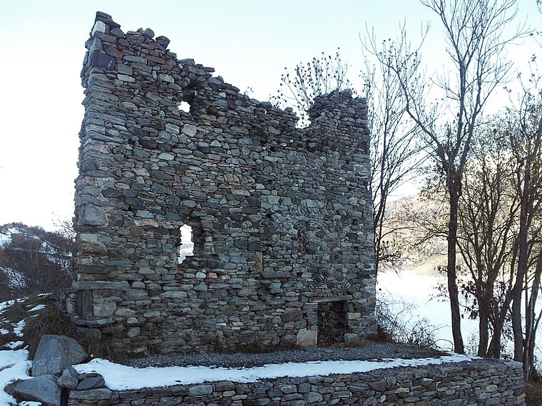
Photo: Amagra lacroix, CC BY-SA 3.0.
Medieval castle ruins stone house and the ruins of a Zwingherren castle is situated 2½ km northwest of Bürchen Zenhäusern.
Raron airfield
Aerodrome

Photo: Carsten Steger, CC BY-SA 4.0.
Raron airfield is an aerodrome, which is situated 2½ km north of Bürchen Zenhäusern.
Places in the Area
Nearby places include Moosalp and Raron.
Moosalp
Locality

Photo: Daniel Reust, CC BY-SA 4.0.
The Moosalp is a high mountain pass across the western Pennine Alps, connecting Bürchen with Törbel in the canton of Valais in Switzerland. The pass lies north-east of Augstbordhorn. Moosalp is situated 3 km south of Bürchen Zenhäusern.
Raron
Village

Photo: Berger, CC BY-SA 3.0.
Raron is a municipality in the district of Raron in the canton of Valais in Switzerland. Raron is situated 4 km northwest of Bürchen Zenhäusern.
Baltschieder
Village
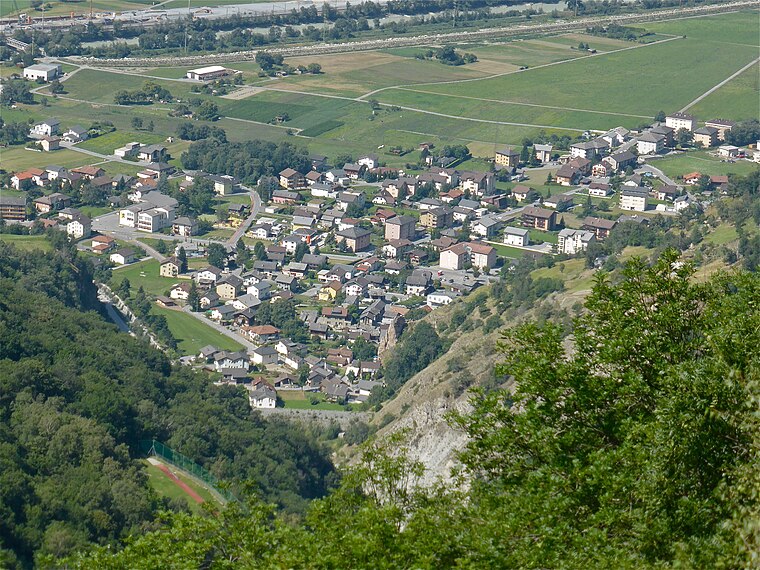
Photo: Albins, CC BY-SA 4.0.
Baltschieder is a municipality in the district of Visp in the canton of Valais in Switzerland. Baltschieder is situated 4½ km northeast of Bürchen Zenhäusern.
Bürchen Zenhäusern
- Type: Sign
- Categories: information and tourism
- Location: Bürchen, Raron District, Valais, Switzerland, Central Europe, Europe
- View on OpenStreetMap
Latitude
46.27988° or 46° 16′ 48″ northLongitude
7.82197° or 7° 49′ 19″ eastElevation
1,444 metres (4,738 feet)Open location code
8FR97RHC+XQOpenStreetMap ID
node 8918804239OpenStreetMap feature
tourism=information
This page is based on OpenStreetMap, Wikidata, and Wikimedia Commons.
We’d love your help improving our open data sources. Thank you for contributing.
Satellite Map
Discover Bürchen Zenhäusern from above in high-definition satellite imagery.
Notable Places Nearby
Highlights include Stellplatz Camp Bietschhorn and Schiessverein Eintracht.
Nearby Places
Explore places such as Kaffeeklatsch Manufaktur and Bürchen, Zenhäusern.
Valais: Must-Visit Destinations
Delve into Sion, Zermatt, Martigny, and Brig.
Curious Places to Discover
Uncover intriguing places from every corner of the globe.
About Mapcarta. Data © OpenStreetMap contributors and available under the Open Database License". Text is available under the CC BY-SA 4.0 license, except for photos, directions, and the map. Photo: Debugman, CC BY 3.0.