Les Mancelles
Les Mancelles is in Mont Dore, Arrondissement of Issoire, Auvergne-Rhône-Alpes and has an elevation of 1,160 metres. Les Mancelles is situated nearby to the pitch Puy-de-l’angle-et-du-mareuilh - officiel-du-mont-dore, as well as near the park Parc des Léchades.| Tap on a place to explore it |
Places of Interest Nearby
Highlights include Le Capucin and Col de la Croix Saint-Robert.

Col de la Croix Saint-Robert
Mountain saddle
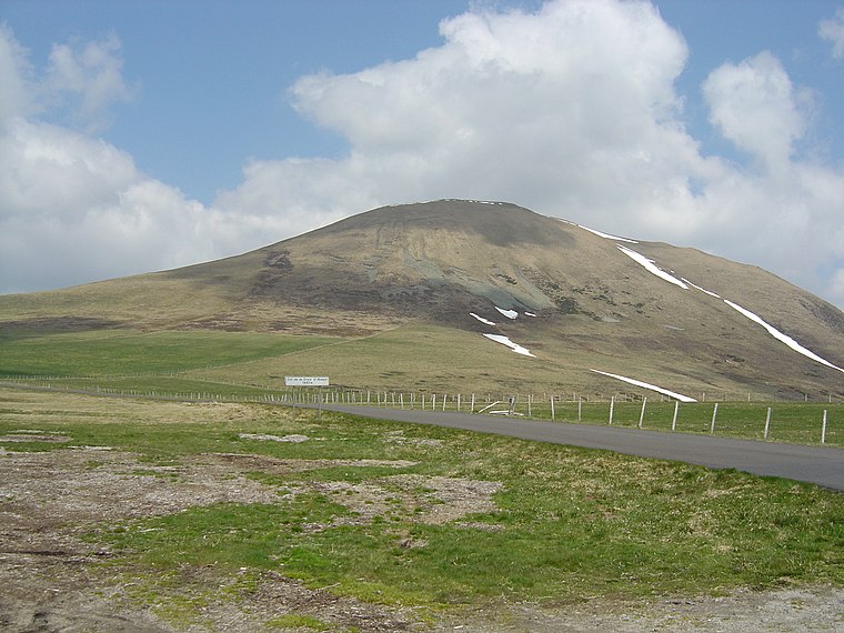
Photo: Anthospace, CC BY-SA 3.0.
Col de la Croix Saint-Robert is a mountain saddle.
Puy de Cliergue
Scenic viewpoint
 Puy de Cliergue is a scenic viewpoint, which is situated 2 km southwest of Les Mancelles.
Les Mancelles
- Type: Sign
- Categories: information and tourism
- Location: Mont Dore, Arrondissement of Issoire, Puy-de-Dôme, Auvergne, Auvergne-Rhône-Alpes, France, Europe
- View on OpenStreetMap
Latitude
45.55848° or 45° 33′ 31″ northLongitude
2.81335° or 2° 48′ 48″ eastElevation
1,160 metres (3,806 feet)Open location code
8FQ4HR57+98OpenStreetMap ID
node 8935260315OpenStreetMap feature
tourism=information
This page is based on OpenStreetMap, Wikidata, and Wikimedia Commons.
We’d love your help improving our open data sources. Thank you for contributing.
Satellite Map
Discover Les Mancelles from above in high-definition satellite imagery.
Places with the Same Name
Discover other places named “Les Mancelles”.
Notable Places Nearby
Highlights include Puy-de-l’angle-et-du-mareuilh - officiel-du-mont-dore and Parc des Léchades.
Nearby Places
Explore places such as Auberge des Mancelles and Les Mancelles.
Auvergne: Must-Visit Destinations
Delve into Clermont-Ferrand, Vichy, Aurillac, and Le Puy-en-Velay.
Curious Places to Discover
Uncover intriguing places from every corner of the globe.
About Mapcarta. Data © OpenStreetMap contributors and available under the Open Database License". Text is available under the CC BY-SA 4.0 license, except for photos, directions, and the map. Photo: Torsade de Pointes, CC0.