Le Bouillet Mine de sel
Le Bouillet Mine de sel is in Valais, Switzerland. Le Bouillet Mine de sel is situated nearby to Reservoir Ronde, as well as near Reservoir Marie-Louise.| Tap on a place to explore it |
Places of Interest Nearby
Highlights include Bévieux station and Reformed Church.
Bévieux station
Railway station
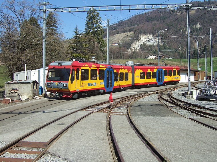
Photo: trams aux fils., CC BY 2.0.
Bévieux station is a railway station, which is situated 2 km south of Le Bouillet Mine de sel.
Reformed Church
Church

Photo: Emmanuelle Adjoa Bessi, CC BY-SA 4.0.
Reformed Church is situated 1½ km north of Le Bouillet Mine de sel.
Ergnaud Castle
Archaeological site
The Castle of Ergnaud is an historic ruin located on a hill close to Plan-Saugey, in the municipality of Bex, Switzerland. Ergnaud Castle is situated 2 km southeast of Le Bouillet Mine de sel.
Places in the Area
Nearby places include Huémoz and Gryon.
Gryon
Village

Photo: Dave Gough, CC BY 2.0.
Gryon is a municipality of the canton of Vaud in Switzerland, located in the district of Aigle. The entire village of Gryon and the Taveyanne area are designated as part of the Inventory of Swiss Heritage Sites. Gryon is situated 3 km east of Le Bouillet Mine de sel.
Bex
Village

Photo: Björn S..., CC BY-SA 2.0.
Bex is a municipality in the canton of Vaud, Switzerland, located in the district of Aigle. It is a few kilometers south of its sister town municipality of Aigle. Bex is situated 3 km south of Le Bouillet Mine de sel.
Le Bouillet Mine de sel
- Type: Sign
- Categories: information and tourism
- Location: Valais, Switzerland, Central Europe, Europe
- View on OpenStreetMap
Latitude
46.27729° or 46° 16′ 38″ northLongitude
7.02603° or 7° 1′ 34″ eastElevation
588 metres (1,929 feet)Open location code
8FR972GG+WCOpenStreetMap ID
node 8936552838OpenStreetMap feature
tourism=information
This page is based on OpenStreetMap, Wikidata, and Wikimedia Commons.
We’d love your help improving our open data sources. Thank you for contributing.
Satellite Map
Discover Le Bouillet Mine de sel from above in high-definition satellite imagery.
Notable Places Nearby
Highlights include Reservoir Ronde and Reservoir Marie-Louise.
Nearby Places
Explore places such as Mines de Sel and Auberge du Bouillet chez le Chat.
Valais: Must-Visit Destinations
Delve into Sion, Zermatt, Martigny, and Brig.
Curious Places to Discover
Uncover intriguing places from every corner of the globe.
About Mapcarta. Data © OpenStreetMap contributors and available under the Open Database License". Text is available under the CC BY-SA 4.0 license, except for photos, directions, and the map. Photo: Debugman, CC BY 3.0.