Ciudad Ventura #2
Ciudad Ventura #2 is a convenience store in San José Province, Costa Rica. Ciudad Ventura #2 is situated nearby to the park Parque Favorita Norte 3, as well as near the police station Fuerza Pública - Dirección Regional San José.| Tap on a place to explore it |
Places of Interest Nearby
Highlights include Tobías Bolaños International Airport and Parque Diversiones.
Tobías Bolaños International Airport
Aerodrome
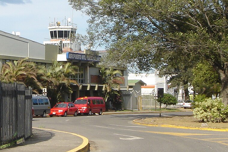
Photo: Mariordo, CC BY-SA 3.0.
Tobías Bolaños International Airport is one of four international airports in Costa Rica, and the secondary airport serving the city of San José, after Juan Santamaría International Airport.
Parque Diversiones
Theme park

Photo: ArquiWHAT, CC BY-SA 4.0.
El Parque Diversiones Dr. Roberto Ortiz Brenes, is an amusement park located in San José, Costa Rica. The park's motto is "healthy children help sick children". Parque Diversiones is situated 1 km north of Ciudad Ventura #2.
British School of Costa Rica
School

Photo: Mercezu, CC BY-SA 3.0.
British School of Costa Rica is situated 580 metres west of Ciudad Ventura #2.
Places in the Area
Nearby places include Uruca and Escazú.
Uruca
Village
Uruca is the seventh district of the San José canton, in the San José province of Costa Rica. It is an important industrial and commercial area of San José. Uruca is situated 3 km east of Ciudad Ventura #2.
Escazú
Town

Photo: Armando Maynez, CC BY 2.0.
Escazú is a district of the Escazú canton, in the San José province of Costa Rica. Escazú is situated 4 km south of Ciudad Ventura #2.
Hatillo
Village
Hatillo is the tenth district of the San José canton, in the San José province of Costa Rica. Hatillo is situated 4½ km southeast of Ciudad Ventura #2.
Ciudad Ventura #2
- Type: Convenience store
- Categories: shop and food
- Location: San José Province, Costa Rica, Central America, North America
- View on OpenStreetMap
Latitude
9.95156° or 9° 57′ 6″ northLongitude
-84.12868° or 84° 7′ 43″ westOpen location code
66XQXV2C+JGOpenStreetMap ID
node 898516213OpenStreetMap feature
shop=convenience
This page is based on OpenStreetMap, Wikidata, and Wikimedia Commons.
We’d love your help improving our open data sources. Thank you for contributing.
Satellite Map
Discover Ciudad Ventura #2 from above in high-definition satellite imagery.
Notable Places Nearby
Highlights include Parque Favorita Norte 3 and Fuerza Pública - Dirección Regional San José.
Nearby Places
Explore places such as Condominio Sorrento and Super Irwing.
Costa Rica: Must-Visit Destinations
Delve into San José, Alajuela, Puerto Limón, and Liberia.
Curious Convenience Stores to Discover
Uncover intriguing convenience stores from every corner of the globe.
About Mapcarta. Data © OpenStreetMap contributors and available under the Open Database License". Text is available under the CC BY-SA 4.0 license, except for photos, directions, and the map. Photo: Andy Rusch, CC BY 2.0.