Flamol
Flamol is a gas station in Canton of Bern, Switzerland. Flamol is situated nearby to Ringgenberg railway station, as well as near the playground Sagi Spielplatz.| Tap on a place to explore it |
Places of Interest Nearby
Highlights include Ringgenberg railway station and Burgseeli.
Ringgenberg railway station
Railway station

Photo: Rennett Stowe, CC BY 2.0.
Ringgenberg railway station is a Swiss railway station in the village and municipality of Ringgenberg and the canton of Bern. Ringgenberg is a stop on the Brünig line, owned by the Zentralbahn, that operates between Interlaken and Lucerne. Ringgenberg railway station is situated 350 metres southwest of Flamol.
Burgseeli
Lake

Photo: Wikimedia, Public domain.
Burgseeli is a lake in the canton of Bern, Switzerland. Its surface area is 5.25 ha. It is located between Ringgenberg and Goldswil on the northern shore of Lake Brienz.
Schadburg ruin
Castle

Photo: Huck1974, CC BY-SA 4.0.
Schadburg ruin is a castle, which is situated 1¼ km northeast of Flamol.
Places in the Area
Nearby places include Ringgenberg and Bönigen.
Ringgenberg
Village

Photo: Thisisbossi, CC BY-SA 2.5.
Ringgenberg is a village and a municipality in the Interlaken-Oberhasli administrative district in the canton of Bern in Switzerland. Besides the village of Ringgenberg, the municipality also includes the village of Goldswil.
Bönigen
Village
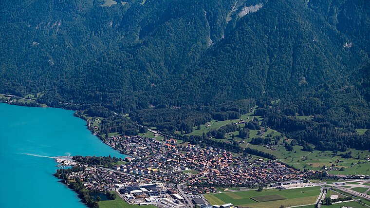
Photo: Espandero, CC BY-SA 4.0.
Bönigen is a village and municipality in the Interlaken-Oberhasli administrative district in the Swiss canton of Bern. It lies on the shore of Lake Brienz, near to the mouth of the river Lütschine, and adjacent to the resort town of Interlaken.
Habkern
Village

Photo: DidiWeidmann, CC BY-SA 3.0.
Habkern is a municipality in the Interlaken-Oberhasli administrative district in the canton of Bern in Switzerland. The municipality includes the settlements of Bohlseiten, Bort, Schwendi and Mittelbäuert. Habkern is situated 4 km northwest of Flamol.
Flamol
- Type: Gas station
- Wheelchair access: yes
- Category: transportation
- Location: Canton of Bern, Switzerland, Central Europe, Europe
- View on OpenStreetMap
Latitude
46.70588° or 46° 42′ 21″ northLongitude
7.90335° or 7° 54′ 12″ eastOperator
FlamolOpen location code
8FR9PW43+98OpenStreetMap ID
node 899266012OpenStreetMap feature
amenity=fuelOpenStreetMap attribute
wheelchair=yes
This page is based on OpenStreetMap, Wikidata, and Wikimedia Commons.
We’d love your help improving our open data sources. Thank you for contributing.
Satellite Map
Discover Flamol from above in high-definition satellite imagery.
Notable Places Nearby
Highlights include Sagi Spielplatz and Gemeindeverwaltung Ringgenberg.
Nearby Places
Explore places such as Suter AG and Abwasserpumpwerk.
Switzerland: Must-Visit Destinations
Delve into Zurich, Berne, Geneva, and Basel.
Curious Gas Stations to Discover
Uncover intriguing gas stations from every corner of the globe.
About Mapcarta. Data © OpenStreetMap contributors and available under the Open Database License". Text is available under the CC BY-SA 4.0 license, except for photos, directions, and the map. Photo: Simonizer, CC BY-SA 2.0 de.