unverpackt saar
unverpackt saar is a convenience store in Saarlouis, Saarland. unverpackt saar is situated nearby to Casino Saarlouis, as well as near the tourism office Tourist-Information.| Tap on a place to explore it |
Places of Interest Nearby
Highlights include St. Ludwig and Rathaus Saarlouis.

Rathaus Saarlouis
Town hall
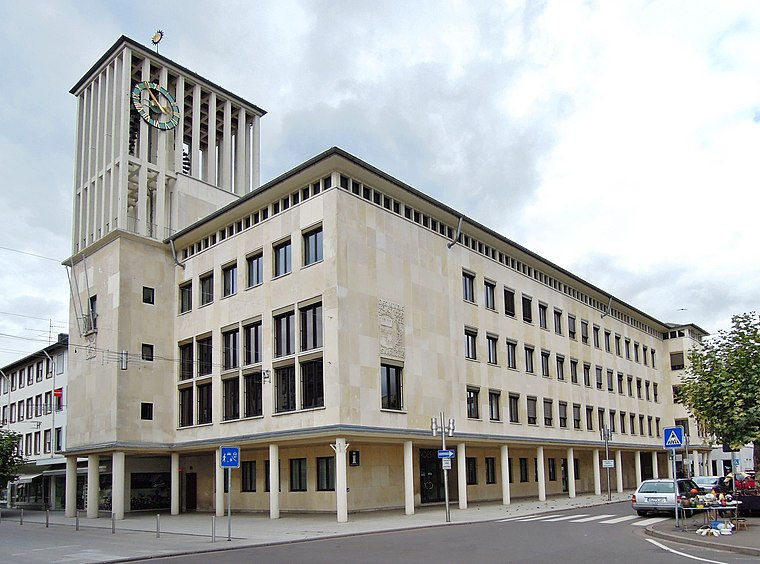
Photo: LoKiLeCh, CC BY-SA 3.0.
Rathaus Saarlouis is a town hall, which is situated 180 metres northwest of unverpackt saar.
Kommandantur

Photo: Xocolatl, Public domain.
Kommandantur is situated 170 metres west of unverpackt saar.
Places in the Area
Nearby places include Beaumarais and Ensdorf.

Ensdorf
Village

Photo: Lokilech, CC BY-SA 3.0.
Ensdorf is a municipality in the district of Saarlouis, in Saarland, Germany. It is on the right bank of the river Saar, opposite Saarlouis, approximately 20 km northwest of Saarbrücken. Ensdorf is situated 2½ km southeast of unverpackt saar.
Wallerfangen
Village

Photo: Kolling, CC BY-SA 3.0.
Wallerfangen is a municipality of Saarlouis district, Saarland, Germany. Located west of Saarlouis and along the French border, it is the seat of the villages of Ittersdorf, Ihn, Leidingen, St. Wallerfangen is situated 3 km northwest of unverpackt saar.
unverpackt saar
- Type: Convenience store
- Categories: shop and food
- Location: Saarlouis, Saarlouis, Saarland, Germany, Central Europe, Europe
- View on OpenStreetMap
Latitude
49.31559° or 49° 18′ 56″ northLongitude
6.75204° or 6° 45′ 7″ eastOpen location code
8FX88Q82+6ROpenStreetMap ID
node 9023067725OpenStreetMap feature
shop=convenience
This page is based on OpenStreetMap, Wikidata, and Wikimedia Commons.
We’d love your help improving our open data sources. Thank you for contributing.
Satellite Map
Discover unverpackt saar from above in high-definition satellite imagery.
Notable Places Nearby
Highlights include Casino Saarlouis and Tourist-Information.
Nearby Places
Explore places such as Isidor Juda and Rosa Juda.
Saarland: Must-Visit Destinations
Delve into Saarbrücken, Homburg, Merzig, and Neunkirchen.
Curious Convenience Stores to Discover
Uncover intriguing convenience stores from every corner of the globe.
About Mapcarta. Data © OpenStreetMap contributors and available under the Open Database License". Text is available under the CC BY-SA 4.0 license, except for photos, directions, and the map. Photo: wolfgangstaudt, CC BY 2.0.