Dianas Feinkost
Dianas Feinkost is a delicatessen in Ratingen, Mettmann, North Rhine-Westphalia. Dianas Feinkost is situated nearby to the fire station Freiwillige Feuerwehr Ratingen, LZ 4 Lintorf, as well as near the library Stadtbibliothek Ratingen-Lintorf.| Tap on a place to explore it |
Places of Interest Nearby
Highlights include Catholic Church St. Anna, Ratingen Lintorf and Helpensteinmühle.
Catholic Church St. Anna, Ratingen Lintorf
Church

Photo: Tuxyso, CC BY-SA 3.0.
Catholic Church St. Anna, Ratingen Lintorf is situated 280 metres south of Dianas Feinkost.
Helpensteinmühle

Photo: Pelz, CC BY-SA 3.0.
Helpensteinmühle is situated 410 metres south of Dianas Feinkost.
Burg Angermund
Castle

Photo: Beckstet, CC BY-SA 3.0.
Burg Angermund is a castle, which is situated 2½ km west of Dianas Feinkost.
Places in the Area
Nearby places include Ratingen-Lintorf and Ratingen-Breitscheid.
Ratingen-Lintorf
Suburb
Photo: Pelz, CC BY-SA 3.0.
Lintorf is a village at the transition of the Berg region into the lower Rhine plain in North Rhine-Westphalia, Germany. Since 1975 it has been a quarter of the city of Ratingen.
Ratingen-Breitscheid
Village
Photo: Wikimedia, CC BY-SA 3.0.
Breitscheid is a quarter of the city Ratingen in Germany. Ratingen-Breitscheid is situated 3½ km northeast of Dianas Feinkost.
Angermund
Suburb
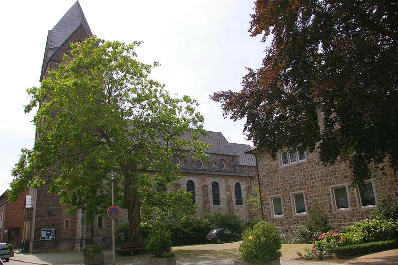
Photo: Udo Garding, CC BY 3.0.
Angermund is an urban quarter of Düsseldorf, part of Borough 5. Angermund is the northernmost part of Düsseldorf, neighbouring to Kalkum, Kaiserswerth, Ratingen and Duisburg. Angermund is situated 3½ km west of Dianas Feinkost.
Dianas Feinkost
- Opening hours:
Monday—Friday: 9:00 AM—7:00 PM
Saturday: 9:00 AM—2:00 PM - Type: Delicatessen
- Categories: shop and food
- Location: Ratingen, Mettmann, Düsseldorf, North Rhine-Westphalia, Germany, Central Europe, Europe
- View on OpenStreetMap
Latitude
51.33445° or 51° 20′ 4″ northLongitude
6.83223° or 6° 49′ 56″ eastOpen location code
9F388RMJ+QVOpenStreetMap ID
node 9070533635OpenStreetMap feature
shop=deli
This page is based on OpenStreetMap, Wikidata, and Wikimedia Commons.
We’d love your help improving our open data sources. Thank you for contributing.
Satellite Map
Discover Dianas Feinkost from above in high-definition satellite imagery.
Notable Places Nearby
Highlights include Freiwillige Feuerwehr Ratingen, LZ 4 Lintorf and Stadtbibliothek Ratingen-Lintorf.
Nearby Places
Explore places such as Istambul and El Pescador.
North Rhine-Westphalia: Must-Visit Destinations
Delve into Cologne, Düsseldorf, Bonn, and Dortmund.
Curious Delicatessens to Discover
Uncover intriguing delicatessens from every corner of the globe.
About Mapcarta. Data © OpenStreetMap contributors and available under the Open Database License". Text is available under the CC BY-SA 4.0 license, except for photos, directions, and the map. Photo: Daniel Schwen, CC BY-SA 2.5.