Dalgas Kiosken
Dalgas Kiosken is a kiosk in Frederiksberg Municipality, Capital Region. Dalgas Kiosken is situated nearby to the residential area Dalgas Have, as well as near the metro station Lindevang station.| Tap on a place to explore it |
Places of Interest Nearby
Highlights include Lindevang station and Frederiksberg Hospital.
Lindevang station
Metro station
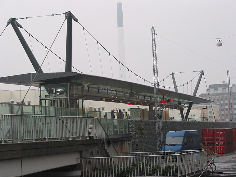
Photo: Urbanus, Public domain.
Lindevang station is a rapid transit station on the Copenhagen Metro in Frederiksberg, Denmark. It serves the M1 and M2 lines. It is located where the Metro line crosses Dalgas Boulevard in Frederiksberg. Lindevang station is situated 230 metres south of Dalgas Kiosken.
Frederiksberg Hospital
Hospital

Photo: Wikimedia, CC BY-SA 3.0.
Frederiksberg Hospital is a medium-sized government-owned general hospital located in Frederiksberg, Denmark. It has 380 beds and an emergency department. The hospital is a teaching hospital for medical students from Copenhagen University. Frederiksberg Hospital is situated 560 metres east of Dalgas Kiosken.
Lindevangsparken
Park

Photo: Ramblersen, CC BY-SA 4.0.
Lindevangsparken is a public park in the Frederiksberg district of Copenhagen Denmark. It is in the so-called Lindevang neighbourhood between Peter Bangs Vej to the south and Finsensvej to the north.
Places in the Area
Nearby places include Frederiksberg and Nuuks Plads.
Frederiksberg

Photo: Elgaard, CC BY-SA 3.0.
Frederiksberg might look like a part of Copenhagen to a traveller, but the municipality of Frederiksberg is an enclave of 103,000 people inside the municipality of Copenhagen.

Vanløse
Suburb
Vanløse is one of the 10 official districts of Copenhagen Municipality, Denmark. It lies on the western border of the municipality. Vanløse covers an area of 6.69 km2, and has a population of 36,115, making Vanløse the smallest district of Copenhagen, by population.
Dalgas Kiosken
- Type: Kiosk
- Category: shop
- Location: Frederiksberg Municipality, Capital Region, Denmark, Nordic countries, Europe
- View on OpenStreetMap
Latitude
55.6855° or 55° 41′ 8″ northLongitude
12.51396° or 12° 30′ 50″ eastOperator
Øvrige engros-kæderOpen location code
9F7JMGP7+5HOpenStreetMap ID
node 9089831026OpenStreetMap feature
shop=kiosk
This page is based on OpenStreetMap, Wikidata, and Wikimedia Commons.
We’d love your help improving our open data sources. Thank you for contributing.
Satellite Map
Discover Dalgas Kiosken from above in high-definition satellite imagery.
Notable Places Nearby
Highlights include Dalgas Have and Skolen på La Cours Vej.
Nearby Places
Explore places such as Diva Pizza & Brugerhouse and Edward Tesdorpf.
Denmark: Must-Visit Destinations
Delve into Copenhagen, Aarhus, Odense, and Aalborg.
Curious Kiosks to Discover
Uncover intriguing kiosks from every corner of the globe.
About Mapcarta. Data © OpenStreetMap contributors and available under the Open Database License". Text is available under the CC BY-SA 4.0 license, except for photos, directions, and the map. Photo: Wikimedia, CC BY-SA 3.0.