Strelasee
Strelasee is in Davos, Graubünden and has an elevation of 2,402 metres. Strelasee is situated nearby to the mountain saddle Strelapass, as well as near the peak Chüpfenflue.| Tap on a place to explore it |
Places of Interest Nearby
Highlights include Strela and Chüpfenflue.
Strela
Peak

Photo: Capricorn4049, CC BY-SA 4.0.
The Strela is a mountain of the Plessur Alps, located between Langwies and Davos in the Swiss canton of Graubünden.
Chüpfenflue
Peak

Photo: Andres Passwirth, CC BY-SA 3.0.
The Chüpfenflue is a mountain of the Plessur Alps, located between Langwies and Davos in the Swiss canton of Graubünden.

Places in the Area
Nearby places include Davos Platz and Medergen.
Davos Platz
Suburb

Photo: MadGeographer, CC BY-SA 3.0.
Davos is an Alpine resort town and municipality in the Prättigau/Davos Region in the canton of the Grisons, Switzerland. It has a permanent population of 10,832. Davos Platz is situated 2½ km southeast of Strelasee.
Medergen
Hamlet

Photo: Andres Passwirth, CC BY-SA 3.0.
Medergen is a hamlet, which is situated 4 km west of Strelasee.
Davos Frauenkirch
Hamlet
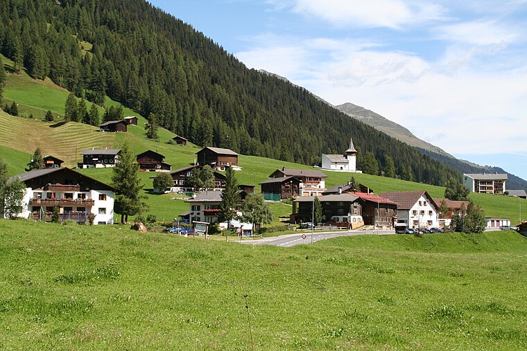
Photo: Parpan05, CC BY-SA 3.0.
Davos Frauenkirch is a hamlet, which is situated 4 km south of Strelasee.
Strelasee
- Type: Sign
- Categories: information and tourism
- Location: Davos, Region Prättigau / Davos, Graubünden, Switzerland, Central Europe, Europe
- View on OpenStreetMap
Latitude
46.80633° or 46° 48′ 23″ northLongitude
9.79045° or 9° 47′ 26″ eastElevation
2,402 metres (7,881 feet)Operator
BAW Bündner WanderwegeOpen location code
8FRFRQ4R+G5OpenStreetMap ID
node 9116272730OpenStreetMap feature
tourism=information
This page is based on OpenStreetMap, Wikidata, and Wikimedia Commons.
We’d love your help improving our open data sources. Thank you for contributing.
Satellite Map
Discover Strelasee from above in high-definition satellite imagery.
Notable Places Nearby
Highlights include Latschüelfurgga and Wannengrat.
Nearby Places
Explore places such as Strelasee and Station Strelapass.
Graubünden: Must-Visit Destinations
Delve into Chur, St. Moritz, Arosa, and Klosters.
Curious Places to Discover
Uncover intriguing places from every corner of the globe.
About Mapcarta. Data © OpenStreetMap contributors and available under the Open Database License". Text is available under the CC BY-SA 4.0 license, except for photos, directions, and the map. Photo: Flyout, CC BY-SA 3.0.