Sprinkles and More
Sprinkles and More is an ice cream parlor in Borough of Hawthorne, Passaic County, New Jersey. Sprinkles and More is situated nearby to the fire station Hawthorne Fire Company Number 1, as well as near Rea Avenue Reformed Church.| Tap on a place to explore it |
Places of Interest Nearby
Highlights include Hawthorne High School and Glen Rock–Main Line station.
Hawthorne High School
School

Photo: Ted Kerwin, CC BY 2.0.
Hawthorne High School is a four-year comprehensive public high school that serves students in 9th through twelfth grades from Hawthorne, in Passaic County, in the U.S. state of New Jersey. Hawthorne High School is situated 2,900 feet south of Sprinkles and More.
Glen Rock–Main Line station
Railway station

Photo: BappleBusiness, CC BY-SA 4.0.
Glen Rock–Main Line is one of two railroad stations operated by New Jersey Transit in the borough of Glen Rock, Bergen County, New Jersey, United States on the Main Line. Glen Rock–Main Line station is situated 1¼ miles east of Sprinkles and More.
Hawthorne Gospel Church
Church
Hawthorne Gospel Church in Hawthorne, New Jersey, is a non-denominational church located in northern New Jersey, being located along a major highway, New Jersey Route 208. Hawthorne Gospel Church is situated 1 mile north of Sprinkles and More.
Places in the Area
Nearby places include Hawthorne and Glen Rock.
Hawthorne
Town

Photo: Lithium6ion, Public domain.
Hawthorne is a borough in Passaic County, New Jersey, United States. As of the 2020 United States census, the borough's population was 19,637, an increase of 846 from the 2010 census count of 18,791, which in turn reflected an increase of 573 from the 18,218 counted in the 2000 census.
Glen Rock

Photo: Beatrice Murch, CC BY-SA 2.0.
Glen Rock is a borough in Bergen County, in the U.S. state of New Jersey. As of the 2020 United States census, the borough's population was 12,133, an increase of 532 from the 2010 census count of 11,601, which in turn reflected an increase of 55 from the 11,546 counted in the 2000 census.
Ridgewood
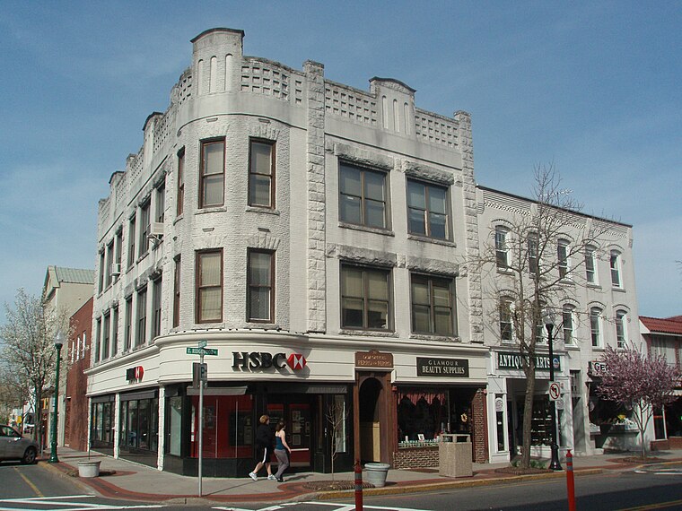
Photo: Alexisrael, CC BY-SA 3.0.
Ridgewood is a village of 25,000 people in New Jersey. It is a suburban bedroom community of New York City, about 20 miles northwest of Midtown Manhattan. This article also covers the adjacent community of Ho-Ho-Kus.
Sprinkles and More
- Type: Ice cream parlor
- Category: food
- Location: Borough of Hawthorne, Passaic County, Gateway, New Jersey, Mid-Atlantic, United States, North America
- View on OpenStreetMap
Latitude
40.9609° or 40° 57′ 39″ northLongitude
-74.15605° or 74° 9′ 22″ westOpen location code
87G7XR6V+9HOpenStreetMap ID
node 9159450110OpenStreetMap feature
amenity=ice_cream
This page is based on OpenStreetMap, Wikidata, and Wikimedia Commons.
We’d love your help improving our open data sources. Thank you for contributing.
Satellite Map
Discover Sprinkles and More from above in high-definition satellite imagery.
Notable Places Nearby
Highlights include Hawthorne Fire Company Number 1 and Rea Avenue Reformed Church.
Nearby Places
Explore places such as Stewart’s Lafayette Deli and Leesman Insurance.
Passaic County: Must-Visit Destinations
Delve into Paterson, Passaic, Clifton, and Wayne.
Curious Ice Cream Parlors to Discover
Uncover intriguing ice cream parlors from every corner of the globe.
About Mapcarta. Data © OpenStreetMap contributors and available under the Open Database License". Text is available under the CC BY-SA 4.0 license, except for photos, directions, and the map. Photo: Wikimedia, CC0.