Münchner Volkshochschule HP8
Münchner Volkshochschule HP8 is a college in Munich, Upper Bavaria, Bavaria. Münchner Volkshochschule HP8 is situated nearby to the arts center Gasteig HP8, as well as near the square Forum.| Tap on a place to explore it |
Places of Interest Nearby
Highlights include Isarphilharmonie and Brudermühl catwalk.
Isarphilharmonie
Theater building
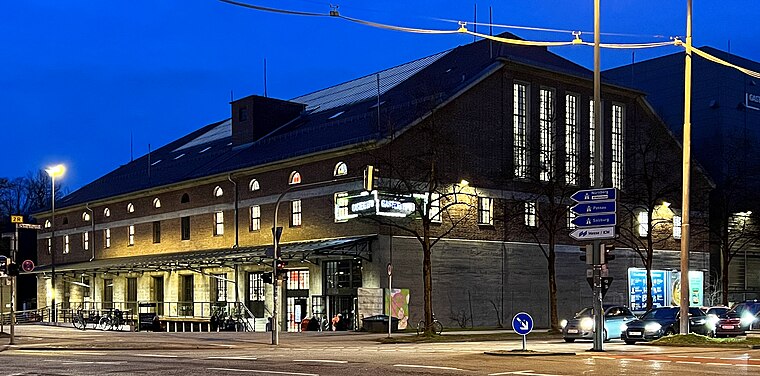
Photo: Pimpinellus, CC BY-SA 4.0.
Isarphilharmonie is a theater building.
Brudermühl catwalk
Bridge

Photo: Chris Falter, CC BY-SA 3.0.
Brudermühl catwalk is a bridge, which is situated 170 metres northeast of Münchner Volkshochschule HP8.
Flaucher
Park

Photo: Schlaier, Public domain.
Flaucher is a park, which is situated 300 metres southeast of Münchner Volkshochschule HP8.
Places in the Area
Nearby places include Untergiesing-Harlaching and Thalkirchen.
Untergiesing-Harlaching
Quarter

Photo: Bjs, CC BY-SA 3.0.
Untergiesing-Harlaching is the 18th borough of Munich, Germany, mostly the districts of Untergiesing and Harlaching. The borough's western border is the river Isar, in the south it borders on Grünwald and the Perlacher Forst, to the north-west on the Munich borough of Obergiesing and to the north on the borough of Au-Haidhausen.

Sendling
Suburb

Photo: Pimpinellus, CC BY-SA 4.0.
Sendling is a borough of Munich. It is located south-west of the city centre and spans the city boroughs Sendling and Sendling-Westpark. Sendling is subdivided into Obersendling, Mittersendling, and Untersendling.
Münchner Volkshochschule HP8
- Type: College
- Wheelchair access: yes
- Category: education
- Location: Munich, Upper Bavaria, Bavaria, Germany, Central Europe, Europe
- View on OpenStreetMap
Latitude
48.11115° or 48° 6′ 40″ northLongitude
11.55423° or 11° 33′ 15″ eastOpen location code
8FWH4H63+FMOpenStreetMap ID
node 9160142017OpenStreetMap feature
amenity=collegeOpenStreetMap attribute
wheelchair=yes
This page is based on OpenStreetMap, Wikidata, and Wikimedia Commons.
We’d love your help improving our open data sources. Thank you for contributing.
Satellite Map
Discover Münchner Volkshochschule HP8 from above in high-definition satellite imagery.
Notable Places Nearby
Highlights include Gasteig HP8 and Forum.
Nearby Places
Explore places such as Haus K and Gaia.
Munich: Must-Visit Destinations
Delve into North Munich, Altstadt, Haidhausen, and Ludwigsvorstadt-Isarvorstadt.
Curious Colleges to Discover
Uncover intriguing colleges from every corner of the globe.
About Mapcarta. Data © OpenStreetMap contributors and available under the Open Database License". Text is available under the CC BY-SA 4.0 license, except for photos, directions, and the map. Photo: Heav84, CC BY-SA 3.0.