CESI École d’ingénieurs - campus d’Arras
CESI École d’ingénieurs - campus d’Arras is a college in Dainville, Arrondissement of Arras, Hauts-de-France. CESI École d’ingénieurs - campus d’Arras is situated nearby to the government office Centre des Finances Publiques, as well as near the church Église Protestante Evangélique.| Tap on a place to explore it |
Places of Interest Nearby
Highlights include Golf d’Arras and Musée des beaux-arts d’Arras.

Musée des beaux-arts d’Arras
Museum
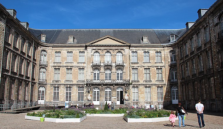
Photo: Jean-Pol GRANDMONT, CC BY 4.0.
The Musée des Beaux-Arts d'Arras is located in the old Abbey of St. Vaast in Arras, in the Nord-Pas-de-Calais, France. Musée des beaux-arts d’Arras is situated 3 km east of CESI École d’ingénieurs - campus d’Arras.
Arras citadel
Protected area

Photo: Liondartois, CC BY-SA 3.0.
Arras citadel is a protected area, which is situated 2½ km southeast of CESI École d’ingénieurs - campus d’Arras.
Places in the Area
Nearby places include Arras.
Arras

Photo: Mélanie Huguet, CC BY-SA 3.0.
Arras is an attractive town in the Hauts-de-France region of France. It was much fought-over in World War I and is mainly visited by tourists travelling from or to the nearby ports of Calais and Boulogne.
CESI École d’ingénieurs - campus d’Arras
- Type: College
- Also known as: “CESI”
- Category: education
- Location: Dainville, Arrondissement of Arras, Pas-de-Calais, Hauts-de-France, France, Europe
- View on OpenStreetMap
Latitude
50.2965° or 50° 17′ 47″ northLongitude
2.73376° or 2° 44′ 2″ eastOpen location code
9F247PWM+JGOpenStreetMap ID
node 9172460129OpenStreetMap feature
amenity=college
This page is based on OpenStreetMap, Wikidata, and Wikimedia Commons.
We’d love your help improving our open data sources. Thank you for contributing.
Satellite Map
Discover CESI École d’ingénieurs - campus d’Arras from above in high-definition satellite imagery.
Notable Places Nearby
Highlights include Centre des Finances Publiques and Église Protestante Evangélique.
Nearby Places
Explore places such as École d’ingénieurs informatique - campus d’Arras and Foyer Jeunes Travailleurs Nobel.
Hauts-de-France: Must-Visit Destinations
Delve into Lille, Dunkirk, Calais, and Amiens.
Curious Places to Discover
Uncover intriguing places from every corner of the globe.
About Mapcarta. Data © OpenStreetMap contributors and available under the Open Database License". Text is available under the CC BY-SA 4.0 license, except for photos, directions, and the map. Photo: Tony62, CC BY-SA 3.0.