Flurkreuz Hauenstein
Flurkreuz Hauenstein is a wayside cross in Krombach, Aschaffenburg, Bavaria. Flurkreuz Hauenstein is situated nearby to the meadow Wildgehege Frühwacht, as well as near the recreation area Reiterstübchen.| Tap on a place to explore it |
Places of Interest Nearby
Highlights include Pfarrkirche and Herrenberg.


Pfarrkirche
Church

Photo: Wikimedia, CC BY-SA 3.0.
Pfarrkirche is a church, which is situated 2½ km southeast of Flurkreuz Hauenstein.
Places in the Area
Nearby places include Dörnsteinbach and Mömbris.

Mömbris
Village
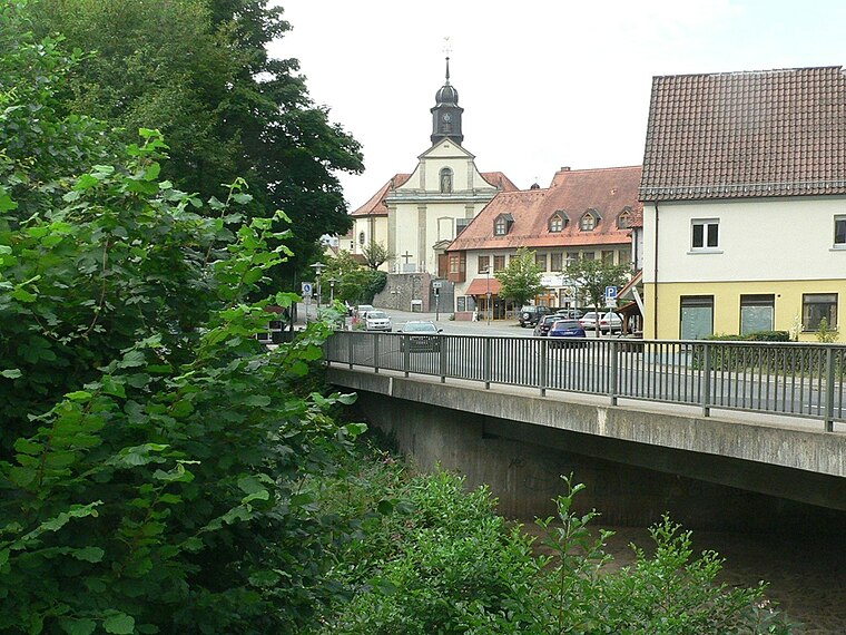
Photo: Geyersberg, CC BY-SA 3.0.
Mömbris is a community – since 31 January 1964 a market community – in the Aschaffenburg district in the Regierungsbezirk of Lower Franconia in Bavaria, Germany. With over 11,000 inhabitants, Mömbris is the district's fifth largest community.
Kaltenberg
Hamlet

Photo: Freak-Line-Community, CC BY-SA 3.0.
Kaltenberg is a hamlet, which is situated 2½ km south of Flurkreuz Hauenstein.
Flurkreuz Hauenstein
- Type: Wayside cross
- Category: historic site
- Location: Krombach, Aschaffenburg, Lower Franconia, Franconia, Bavaria, Germany, Central Europe, Europe
- View on OpenStreetMap
Latitude
50.07859° or 50° 4′ 43″ northLongitude
9.19386° or 9° 11′ 38″ eastInception
1730Open location code
9F2F35HV+CGOpenStreetMap ID
node 918949966OpenStreetMap feature
historic=wayside_cross
This page is based on OpenStreetMap, Wikidata, and Wikimedia Commons.
We’d love your help improving our open data sources. Thank you for contributing.
Satellite Map
Discover Flurkreuz Hauenstein from above in high-definition satellite imagery.
Notable Places Nearby
Highlights include Wildgehege Frühwacht and Reiterstübchen.
Nearby Places
Explore places such as Oberschur 1 and Vorderer Hauenstein.
Lower Franconia: Must-Visit Destinations
Delve into Würzburg, Aschaffenburg, Schweinfurt, and Bad Kissingen.
Curious Wayside Crosses to Discover
Uncover intriguing wayside crosses from every corner of the globe.
About Mapcarta. Data © OpenStreetMap contributors and available under the Open Database License". Text is available under the CC BY-SA 4.0 license, except for photos, directions, and the map. Photo: Benreis, CC BY 3.0.