Kerekeger feredő
Kerekeger feredő is a bathhouse in Miercurea Ciuc, Harghita. Kerekeger feredő is situated nearby to the village Șoimeni, as well as near the peak Șumuleu Mare.| Tap on a place to explore it |
Places of Interest Nearby
Highlights include Șumuleu Mare and Triple altar.

Triple altar
Church

Photo: Locketudor, CC BY-SA 3.0.
Triple altar is a church, which is situated 3 km west of Kerekeger feredő.
Saints Peter and Paul Parish Church (Cioboteni)
Church
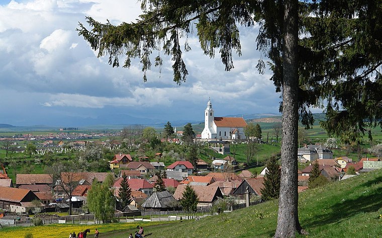
Photo: Thaler Tamas, CC BY-SA 3.0.
Saints Peter and Paul Parish Church (Cioboteni) is situated 3 km west of Kerekeger feredő.
Places in the Area
Nearby places include Șoimeni and Cioboteni.

Cioboteni
Suburb
Photo: Thaler Tamas, CC BY-SA 3.0.
Cioboteni is a suburb, which is situated 2½ km west of Kerekeger feredő.
Păuleni-Ciuc
Village
 Păuleni-Ciuc is a village, which is situated 3½ km northwest of Kerekeger feredő.
Kerekeger feredő
- Type: Bathhouse
- Location: Miercurea Ciuc, Harghita, Szeklerland, Transylvania, Romania, Balkans, Europe
- View on OpenStreetMap
Latitude
46.38122° or 46° 22′ 52″ northLongitude
25.87133° or 25° 52′ 17″ eastOpen location code
8GR79VJC+FGOpenStreetMap ID
node 9228332042OpenStreetMap feature
amenity=public_bath
This page is based on OpenStreetMap, Wikidata, and Wikimedia Commons.
We’d love your help improving our open data sources. Thank you for contributing.
Satellite Map
Discover Kerekeger feredő from above in high-definition satellite imagery.
Notable Places Nearby
Highlights include Apa minerală de la Șoimeni and Legelő.
Nearby Places
Explore places such as Tinerilor Csibész and Szellő Szálló.
Harghita: Must-Visit Destinations
Delve into Băile Tuşnad, Borsec, Dârjiu, and Corund.
Curious Bathhouses to Discover
Uncover intriguing bathhouses from every corner of the globe.
About Mapcarta. Data © OpenStreetMap contributors and available under the Open Database License". Text is available under the CC BY-SA 4.0 license, except for photos, directions, and the map. Photo: Wikimedia, CC0.