Cagnes Est
Cagnes Est is a tollbooth in Cagnes-sur-Mer, Arrondissement of Grasse, Provence-Alpes-Côte d’Azur. Cagnes Est is situated nearby to the garden Square 8 Mai 1945, as well as near the railway station Cagnes-sur-Mer.| Tap on a place to explore it |
Places of Interest Nearby
Highlights include Loup Valley and Cagnes sur Mer Railway Station.
Loup Valley

Photo: Martin Kraft, CC BY-SA 3.0.
The River Loup is in the Alpes Maritimes, France. It is 49 km in length. Its source is a grassy hollow in the Vallon de l'Audibergue. It is fed by streams running down the north face of the Montagne de l'Audibergue.
Cagnes sur Mer Railway Station
Railway station
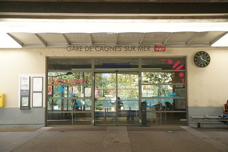
Photo: Dacoucou, CC BY-SA 4.0.
Gare de Cagnes-sur-Mer is a railway station serving Cagnes-sur-Mer, Alpes-Maritimes department, southeastern France. It is located on the Marseille–Ventimiglia railway, between Cannes and Nice. Cagnes sur Mer Railway Station is situated 180 metres south of Cagnes Est.
Château Grimaldi
Museum

Photo: Ariadacapo, CC BY 4.0.
The Château Grimaldi at Cagnes-sur-Mer in the département of Alpes-Maritimes, in France, is built on the site of an earlier fortress occupied by the Greeks and then the Romans. Château Grimaldi is situated 1 km north of Cagnes Est.
Places in the Area
Nearby places include Villeneuve-Loubet and Saint-Laurent-du-Var.
Villeneuve-Loubet
Town

Photo: Ariadacapo, CC BY 4.0.
Villeneuve-Loubet is a commune in the Alpes-Maritimes department in the Provence-Alpes-Côte d'Azur region in Southeastern France. It lies between Cagnes-sur-Mer and Antibes, at the mouth of the river Loup, ten kilometres west of central Nice.
Saint-Laurent-du-Var
Town

Photo: HenrikKbh, CC BY-SA 3.0.
Saint-Laurent-du-Var is a commune in the Alpes-Maritimes department in the Provence-Alpes-Côte d'Azur region on the French Riviera. Saint-Laurent-du-Var is situated 3½ km east of Cagnes Est.
Saint-Paul de Vence

Photo: Dennis G. Jarvis, CC BY-SA 2.0.
St.-Paul-de-Vence, in Alpes-Maritimes, France, is a perfectly preserved medieval village perched on a hillside several kilometres from the Mediterranean.
Cagnes Est
- Type: Tollbooth
- Category: transportation
- Location: Cagnes-sur-Mer, Arrondissement of Grasse, Alpes-Maritimes, Provence-Alpes-Côte d’Azur, France, Europe
- View on OpenStreetMap
Latitude
43.65934° or 43° 39′ 34″ northLongitude
7.14864° or 7° 8′ 55″ eastOperator
ESCOTAOpen location code
8FM9M45X+PFOpenStreetMap ID
node 9317660273
This page is based on OpenStreetMap, Wikidata, and Wikimedia Commons.
We’d love your help improving our open data sources. Thank you for contributing.
Satellite Map
Discover Cagnes Est from above in high-definition satellite imagery.
Notable Places Nearby
Highlights include Square 8 Mai 1945 and Cagnes-sur-Mer.
Nearby Places
Explore places such as Cagnes Est and Gare Cagnes-sur-Mer.
Alpes-Maritimes: Must-Visit Destinations
Delve into Nice, Cannes, Antibes, and Menton.
Curious Tollbooths to Discover
Uncover intriguing tollbooths from every corner of the globe.
About Mapcarta. Data © OpenStreetMap contributors and available under the Open Database License". Text is available under the CC BY-SA 4.0 license, except for photos, directions, and the map. Photo: Kulmalukko, CC BY-SA 3.0.